

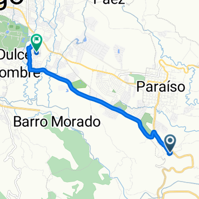
Subida Tucurrique
A cycling route starting in Paraíso, Provincia de Cartago, Costa Rica.
Overview
About this route
trepon
- -:--
- Duration
- 15.6 km
- Distance
- 605 m
- Ascent
- 879 m
- Descent
- ---
- Avg. speed
- ---
- Avg. speed

Route quality
Waytypes & surfaces along the route
Waytypes
Busy road
15.4 km
(99 %)
Quiet road
0.1 km
(<1 %)
Undefined
0 km
(<1 %)
Surfaces
Paved
15.4 km
(99 %)
Paved (undefined)
15.4 km
(99 %)
Undefined
0.1 km
(<1 %)
Continue with Bikemap
Use, edit, or download this cycling route
You would like to ride Subida Tucurrique or customize it for your own trip? Here is what you can do with this Bikemap route:
Free features
- Save this route as favorite or in collections
- Copy & plan your own version of this route
- Sync your route with Garmin or Wahoo
Premium features
Free trial for 3 days, or one-time payment. More about Bikemap Premium.
- Navigate this route on iOS & Android
- Export a GPX / KML file of this route
- Create your custom printout (try it for free)
- Download this route for offline navigation
Discover more Premium features.
Get Bikemap PremiumFrom our community
Other popular routes starting in Paraíso
 De Pocón
- Distance
- 10.8 km
- Ascent
- 165 m
- Descent
- 57 m
- Location
- Paraíso, Provincia de Cartago, Costa Rica
 Paraiso Vuelta Cachi
- Distance
- 73.2 km
- Ascent
- 1,323 m
- Descent
- 1,562 m
- Location
- Paraíso, Provincia de Cartago, Costa Rica
 De R4VQ+JVH, Paraíso a V5QQ+2H2, Cervantes
- Distance
- 10.4 km
- Ascent
- 319 m
- Descent
- 198 m
- Location
- Paraíso, Provincia de Cartago, Costa Rica
 Subida Tucurrique
- Distance
- 15.6 km
- Ascent
- 605 m
- Descent
- 879 m
- Location
- Paraíso, Provincia de Cartago, Costa Rica
 Paraíso de vuelta
- Distance
- 26.3 km
- Ascent
- 5 m
- Descent
- 4 m
- Location
- Paraíso, Provincia de Cartago, Costa Rica
 bike tour from Paraíso to Cartago
- Distance
- 11.7 km
- Ascent
- 235 m
- Descent
- 21 m
- Location
- Paraíso, Provincia de Cartago, Costa Rica
 PARAISO-TURRIALBA-SANTA CRUZ-PARAISO
- Distance
- 84.5 km
- Ascent
- 1,728 m
- Descent
- 1,728 m
- Location
- Paraíso, Provincia de Cartago, Costa Rica
 De 224, Paraíso a Calle 37B, Cartago
- Distance
- 7.1 km
- Ascent
- 216 m
- Descent
- 109 m
- Location
- Paraíso, Provincia de Cartago, Costa Rica
Open it in the app