

Sledgers Towmaster Tour
A cycling route starting in Mulgrave, Victoria, Australia.
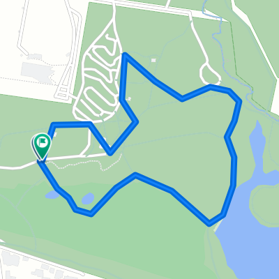
Overview
About this route
A suggested route for the pre-Xmas Saturday Sledgers - some hills but not as bad as the Dirty Dozen. Generally some nice Dandenongs roads that many of the group have not ridden.
- -:--
- Duration
- 87.8 km
- Distance
- 1,046 m
- Ascent
- 1,046 m
- Descent
- ---
- Avg. speed
- ---
- Avg. speed
Route quality
Waytypes & surfaces along the route
Waytypes
Busy road
60.1 km
(68 %)
Quiet road
10.7 km
(12 %)
Surfaces
Paved
71.4 km
(81 %)
Unpaved
0.1 km
(<1 %)
Asphalt
63.3 km
(72 %)
Paved (undefined)
7.5 km
(8 %)
Continue with Bikemap
Use, edit, or download this cycling route
You would like to ride Sledgers Towmaster Tour or customize it for your own trip? Here is what you can do with this Bikemap route:
Free features
- Save this route as favorite or in collections
- Copy & plan your own version of this route
- Sync your route with Garmin or Wahoo
Premium features
Free trial for 3 days, or one-time payment. More about Bikemap Premium.
- Navigate this route on iOS & Android
- Export a GPX / KML file of this route
- Create your custom printout (try it for free)
- Download this route for offline navigation
Discover more Premium features.
Get Bikemap PremiumFrom our community
Other popular routes starting in Mulgrave
 Jells Park to the Basin (trails)
- Distance
- 21.5 km
- Ascent
- 179 m
- Descent
- 87 m
- Location
- Mulgrave, Victoria, Australia
 Jynx
Jynx- Distance
- 2.3 km
- Ascent
- 36 m
- Descent
- 36 m
- Location
- Mulgrave, Victoria, Australia
 Work
Work- Distance
- 13.1 km
- Ascent
- 0 m
- Descent
- 0 m
- Location
- Mulgrave, Victoria, Australia
 Proposed Saturday Ride
- Distance
- 75.5 km
- Ascent
- 942 m
- Descent
- 942 m
- Location
- Mulgrave, Victoria, Australia
 Eastlink to CBD via Scotchmans Creek, Gardiner Creek, Yarra River trails
- Distance
- 32.1 km
- Ascent
- 298 m
- Descent
- 337 m
- Location
- Mulgrave, Victoria, Australia
 South Eastern & Bayside
- Distance
- 76.3 km
- Ascent
- 253 m
- Descent
- 253 m
- Location
- Mulgrave, Victoria, Australia
 Ride through Melbourne's south-east
- Distance
- 41.8 km
- Ascent
- 113 m
- Descent
- 112 m
- Location
- Mulgrave, Victoria, Australia
 Wheelers hill to Dandenong Bypass and back
- Distance
- 24.4 km
- Ascent
- 93 m
- Descent
- 103 m
- Location
- Mulgrave, Victoria, Australia
Open it in the app