

Sierra de Francia, Hurdes y Batuecas
A cycling route starting in Cereceda de la Sierra, Castille and León, Spain.
Overview
About this route
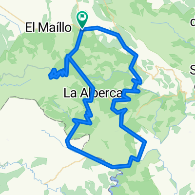
Circular route through the Sierra de Francia, las Hurdes, and Las Batuecas
- -:--
- Duration
- 115.7 km
- Distance
- 2,101 m
- Ascent
- 2,100 m
- Descent
- ---
- Avg. speed
- ---
- Max. altitude

Route quality
Waytypes & surfaces along the route
Waytypes
Road
23.1 km
(20 %)
Path
2.3 km
(2 %)
Surfaces
Paved
86.8 km
(75 %)
Asphalt
86.8 km
(75 %)
Undefined
28.9 km
(25 %)
Continue with Bikemap
Use, edit, or download this cycling route
You would like to ride Sierra de Francia, Hurdes y Batuecas or customize it for your own trip? Here is what you can do with this Bikemap route:
Free features
- Save this route as favorite or in collections
- Copy & plan your own version of this route
- Split it into stages to create a multi-day tour
- Sync your route with Garmin or Wahoo
Premium features
Free trial for 3 days, or one-time payment. More about Bikemap Premium.
- Navigate this route on iOS & Android
- Export a GPX / KML file of this route
- Create your custom printout (try it for free)
- Download this route for offline navigation
Discover more Premium features.
Get Bikemap PremiumFrom our community
Other popular routes starting in Cereceda de la Sierra
 Sierra de Francia y las Hurdes
- Distance
- 120.9 km
- Ascent
- 1,875 m
- Descent
- 1,874 m
- Location
- Cereceda de la Sierra, Castille and León, Spain
 Sierra de Francia, Hurdes y Batuecas
- Distance
- 115.7 km
- Ascent
- 2,101 m
- Descent
- 2,100 m
- Location
- Cereceda de la Sierra, Castille and León, Spain
 Cabaco-Valero-Portillo Batuecas-Peña de Francia
- Distance
- 127.8 km
- Ascent
- 2,168 m
- Descent
- 2,150 m
- Location
- Cereceda de la Sierra, Castille and León, Spain
 Noche de la Bici. Peña de Francia
- Distance
- 53.5 km
- Ascent
- 1,005 m
- Descent
- 1,005 m
- Location
- Cereceda de la Sierra, Castille and León, Spain
 El Cábaco-Los Lobos-Monsagro-Serradilla del Arroyo-Serranilla del Llano-Riomalo de Arriba-Ladrillar-Las Mestas-La Alberca-El Cábaco.
- Distance
- 100.5 km
- Ascent
- 2,006 m
- Descent
- 2,012 m
- Location
- Cereceda de la Sierra, Castille and León, Spain
 Sierra de Francia
- Distance
- 100.2 km
- Ascent
- ---
- Descent
- ---
- Location
- Cereceda de la Sierra, Castille and León, Spain
 Sierra de Francia, Hurdes y Batuecas
- Distance
- 115.7 km
- Ascent
- 2,078 m
- Descent
- 2,080 m
- Location
- Cereceda de la Sierra, Castille and León, Spain
 Ruta de los conventos en la sierra de Francia
- Distance
- 52.3 km
- Ascent
- 879 m
- Descent
- 879 m
- Location
- Cereceda de la Sierra, Castille and León, Spain
Open it in the app