

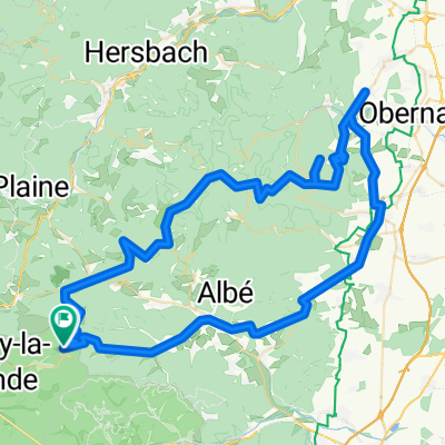
Sainte Croix aux Mines<>Colmar
A cycling route starting in Sainte-Croix-aux-Mines, Grand Est, France.
Overview
About this route
Route 8
- -:--
- Duration
- 46.7 km
- Distance
- 581 m
- Ascent
- 700 m
- Descent
- ---
- Avg. speed
- ---
- Max. altitude

Route quality
Waytypes & surfaces along the route
Waytypes
Busy road
32.1 km
(69 %)
Quiet road
7.2 km
(15 %)
Surfaces
Paved
41.1 km
(88 %)
Unpaved
0.4 km
(<1 %)
Asphalt
39.2 km
(84 %)
Paved (undefined)
1.8 km
(4 %)
Continue with Bikemap
Use, edit, or download this cycling route
You would like to ride Sainte Croix aux Mines<>Colmar or customize it for your own trip? Here is what you can do with this Bikemap route:
Free features
- Save this route as favorite or in collections
- Copy & plan your own version of this route
- Sync your route with Garmin or Wahoo
Premium features
Free trial for 3 days, or one-time payment. More about Bikemap Premium.
- Navigate this route on iOS & Android
- Export a GPX / KML file of this route
- Create your custom printout (try it for free)
- Download this route for offline navigation
Discover more Premium features.
Get Bikemap PremiumFrom our community
Other popular routes starting in Sainte-Croix-aux-Mines
 Rombach-l-Franc 1320HM 70km
- Distance
- 69.8 km
- Ascent
- 1,308 m
- Descent
- 1,314 m
- Location
- Sainte-Croix-aux-Mines, Grand Est, France
 Rombach Straßbourg
- Distance
- 87.4 km
- Ascent
- 371 m
- Descent
- 633 m
- Location
- Sainte-Croix-aux-Mines, Grand Est, France
 Rombach sur Franc 1.4
- Distance
- 71.7 km
- Ascent
- 1,379 m
- Descent
- 1,355 m
- Location
- Sainte-Croix-aux-Mines, Grand Est, France
 Day 5 Cedar
- Distance
- 64.8 km
- Ascent
- 497 m
- Descent
- 695 m
- Location
- Sainte-Croix-aux-Mines, Grand Est, France
 TE_2017_Etappe4
- Distance
- 127.4 km
- Ascent
- 1,754 m
- Descent
- 2,108 m
- Location
- Sainte-Croix-aux-Mines, Grand Est, France
 Rombach le Franc 1.2
- Distance
- 59.9 km
- Ascent
- 1,083 m
- Descent
- 1,076 m
- Location
- Sainte-Croix-aux-Mines, Grand Est, France
 2018 Mont Ste-Odile round trip
- Distance
- 86.7 km
- Ascent
- 1,293 m
- Descent
- 1,296 m
- Location
- Sainte-Croix-aux-Mines, Grand Est, France
 Rombach-l-Franc 920HM-108km
- Distance
- 107.8 km
- Ascent
- 736 m
- Descent
- 737 m
- Location
- Sainte-Croix-aux-Mines, Grand Est, France
Open it in the app