

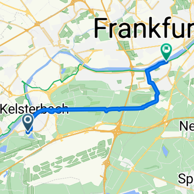
Kelsterbach - Offenbach (19 Km)
A cycling route starting in Kelsterbach, Hesse, Germany.
Overview
About this route
kurze Verbindung mit möglichst wenig Autos und Fußgängern.
Das Teilstück mit starkem Verkehr (Mörfelder Str.) ist so kurz wie möglich gehalten ohne Umwege zu nehmen.
- teilweise schlechte Straße<br />- teilweise unbefestigte Wege<br />- 11 km durch den Wald (10km Schwanheimer Wald/ 1km Louisa)
Kurzer Abriss der benutzten Wege: Langschneise, Golfstraße, Ziegelhüttenweg, Mörfelderlandstr., Im Bärengarten
- -:--
- Duration
- 19 km
- Distance
- 76 m
- Ascent
- 61 m
- Descent
- ---
- Avg. speed
- ---
- Avg. speed
Continue with Bikemap
Use, edit, or download this cycling route
You would like to ride Kelsterbach - Offenbach (19 Km) or customize it for your own trip? Here is what you can do with this Bikemap route:
Free features
- Save this route as favorite or in collections
- Copy & plan your own version of this route
- Sync your route with Garmin or Wahoo
Premium features
Free trial for 3 days, or one-time payment. More about Bikemap Premium.
- Navigate this route on iOS & Android
- Export a GPX / KML file of this route
- Create your custom printout (try it for free)
- Download this route for offline navigation
Discover more Premium features.
Get Bikemap PremiumFrom our community
Other popular routes starting in Kelsterbach
 Kleine Feierabendrunde
- Distance
- 46.2 km
- Ascent
- 380 m
- Descent
- 379 m
- Location
- Kelsterbach, Hesse, Germany
 schwanheim lauf
- Distance
- 9.5 km
- Ascent
- 39 m
- Descent
- 39 m
- Location
- Kelsterbach, Hesse, Germany
 Lücki RR ins Ried 104km/286HM
- Distance
- 110.7 km
- Ascent
- 247 m
- Descent
- 248 m
- Location
- Kelsterbach, Hesse, Germany
 RundwegAirportFfmWest-Worfelden
- Distance
- 34.8 km
- Ascent
- 69 m
- Descent
- 67 m
- Location
- Kelsterbach, Hesse, Germany
 Frankfurt Höchst - Neu Isenburg - Offenbach - Runde
- Distance
- 58.9 km
- Ascent
- 293 m
- Descent
- 294 m
- Location
- Kelsterbach, Hesse, Germany
 UniKlinik-FFM-Kelsterbach-LHS
- Distance
- 13.6 km
- Ascent
- 31 m
- Descent
- 34 m
- Location
- Kelsterbach, Hesse, Germany
 Rundweg um den Frankfurter Flughafen CLONED FROM ROUTE 298299
- Distance
- 41.8 km
- Ascent
- 77 m
- Descent
- 76 m
- Location
- Kelsterbach, Hesse, Germany
 Rüsselsheimer Str, Kelsterbach nach Frankfurter Straße 31, Offenbach am Main
- Distance
- 27.2 km
- Ascent
- 10 m
- Descent
- 14 m
- Location
- Kelsterbach, Hesse, Germany
Open it in the app