

Paso Robles Back Roads
A cycling route starting in Templeton, California, United States of America.
Overview
About this route
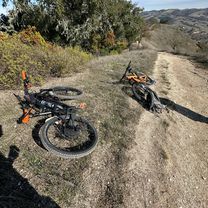
Paso Robles back roads.
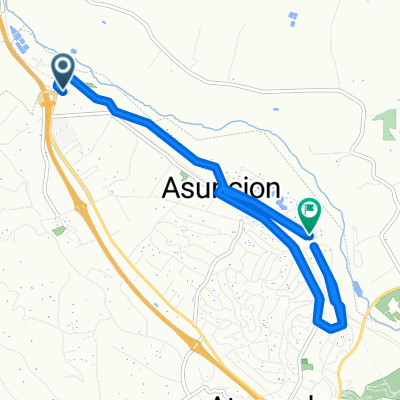
Start @ Turley WineCellars on Rte 46 - -:--
- Duration
- 67.7 km
- Distance
- 706 m
- Ascent
- 705 m
- Descent
- ---
- Avg. speed
- ---
- Avg. speed
Route quality
Waytypes & surfaces along the route
Waytypes
Road
38 km
(56 %)
Quiet road
14.8 km
(22 %)
Surfaces
Paved
7.3 km
(11 %)
Paved (undefined)
6.9 km
(10 %)
Asphalt
0.4 km
(<1 %)
Undefined
60.5 km
(89 %)
Continue with Bikemap
Use, edit, or download this cycling route
You would like to ride Paso Robles Back Roads or customize it for your own trip? Here is what you can do with this Bikemap route:
Free features
- Save this route as favorite or in collections
- Copy & plan your own version of this route
- Sync your route with Garmin or Wahoo
Premium features
Free trial for 3 days, or one-time payment. More about Bikemap Premium.
- Navigate this route on iOS & Android
- Export a GPX / KML file of this route
- Create your custom printout (try it for free)
- Download this route for offline navigation
Discover more Premium features.
Get Bikemap PremiumFrom our community
Other popular routes starting in Templeton
 A-Town RR Ride
- Distance
- 34.4 km
- Ascent
- 112 m
- Descent
- 114 m
- Location
- Templeton, California, United States of America
 Ferro Carril Rd, Atascadero to Templeton high school
- Distance
- 21.1 km
- Ascent
- 376 m
- Descent
- 384 m
- Location
- Templeton, California, United States of America
 Bethel Ride
- Distance
- 8.1 km
- Ascent
- 121 m
- Descent
- 121 m
- Location
- Templeton, California, United States of America
 Paso Robles Back Roads
- Distance
- 67.7 km
- Ascent
- 706 m
- Descent
- 705 m
- Location
- Templeton, California, United States of America
 Snail-like route in Paso Robles
- Distance
- 32.8 km
- Ascent
- 382 m
- Descent
- 381 m
- Location
- Templeton, California, United States of America
 Paso Robles Wineries
- Distance
- 20.4 km
- Ascent
- 287 m
- Descent
- 287 m
- Location
- Templeton, California, United States of America
 El Camino Real 910, Atascadero to El Camino Real 815, Atascadero
- Distance
- 25.1 km
- Ascent
- 148 m
- Descent
- 208 m
- Location
- Templeton, California, United States of America
 Paso Robles Winery2
- Distance
- 26.6 km
- Ascent
- 262 m
- Descent
- 263 m
- Location
- Templeton, California, United States of America
Open it in the app