

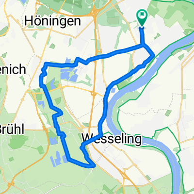
4. Rodenkirchen - Langerwehe
A cycling route starting in Poll, North Rhine-Westphalia, Germany.
Overview
About this route
- Rodenkirchen - Langerwehe
- -:--
- Duration
- 59.8 km
- Distance
- 175 m
- Ascent
- 81 m
- Descent
- ---
- Avg. speed
- ---
- Avg. speed
Route quality
Waytypes & surfaces along the route
Waytypes
Path
18.2 km
(30 %)
Track
15.7 km
(26 %)
Surfaces
Paved
39.7 km
(66 %)
Unpaved
8.6 km
(14 %)
Asphalt
30.3 km
(51 %)
Paved (undefined)
9.5 km
(16 %)
Continue with Bikemap
Use, edit, or download this cycling route
You would like to ride 4. Rodenkirchen - Langerwehe or customize it for your own trip? Here is what you can do with this Bikemap route:
Free features
- Save this route as favorite or in collections
- Copy & plan your own version of this route
- Sync your route with Garmin or Wahoo
Premium features
Free trial for 3 days, or one-time payment. More about Bikemap Premium.
- Navigate this route on iOS & Android
- Export a GPX / KML file of this route
- Create your custom printout (try it for free)
- Download this route for offline navigation
Discover more Premium features.
Get Bikemap PremiumFrom our community
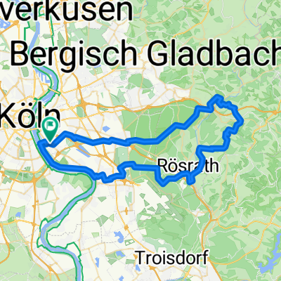
Other popular routes starting in Poll
 Englischer Garten Bonn
- Distance
- 65.4 km
- Ascent
- 99 m
- Descent
- 101 m
- Location
- Poll, North Rhine-Westphalia, Germany
 RTC Rodenkirchen RTF Familientour 24 km Planung 2018
- Distance
- 24.5 km
- Ascent
- 44 m
- Descent
- 45 m
- Location
- Poll, North Rhine-Westphalia, Germany
 Poll-Hohkeppel-Altenrath-Poll
- Distance
- 74.5 km
- Ascent
- 289 m
- Descent
- 291 m
- Location
- Poll, North Rhine-Westphalia, Germany
 65 Gravel Köfo Immek.Heiligenhs.Hoffngthal
- Distance
- 63.6 km
- Ascent
- 1,032 m
- Descent
- 1,031 m
- Location
- Poll, North Rhine-Westphalia, Germany
 Oberländer Ufer 1, Köln nach Vogtstraße 22, Rheinbrohl
- Distance
- 271.8 km
- Ascent
- 1,613 m
- Descent
- 1,598 m
- Location
- Poll, North Rhine-Westphalia, Germany
 Rund um Köln
- Distance
- 43.1 km
- Ascent
- 104 m
- Descent
- 108 m
- Location
- Poll, North Rhine-Westphalia, Germany
 Route in Köln
- Distance
- 34.2 km
- Ascent
- 69 m
- Descent
- 68 m
- Location
- Poll, North Rhine-Westphalia, Germany
 Köln Nideggen Schmidt
- Distance
- 107.5 km
- Ascent
- 910 m
- Descent
- 771 m
- Location
- Poll, North Rhine-Westphalia, Germany
Open it in the app