

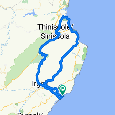
Orosei - Nuoro - Monte Tuttavista - Orosei
A cycling route starting in Orosei, Sardinia, Italy.
Overview
About this route
Auf der SS 129 zunächst über Galtelli in richtung Nuoro. Weiter auf der SP 38 in Richtung Bitti. Parallel zur Autobahn (SS 131) auf der SP 45 nach Nuoro. Der Belag der Straße ist bis zu Beginn der Steigung nach Nuoro rauh. Die schöne Auffahrt nach Nuoro entschädigt aber diesen etwas schlechteren Abschnitt.<br /> Von Nuoro geht es weiter auf der SS 389 über Orune nach Bitti. Die Steigung beträgt nie mehr als 4 % und man kann die schöne einsame Landschaft genießen.<br /> Weiter zunächst auf der Hauptstraße zunächst in Dorgali, nach 9 km links auf die SP 38 und die SP 25 nach Galtelli. In Galtelli in Richtung Monte Tuttavista. Bei dem Monte Tuttavista handelt es sich um einen isoliert stehenden Kalksteinklotz. Man überwindet auf einer schmalen Straße mit einer Gesamtlänge von<br /> 8 km, deren Beleg auf den letzten 4 km sehr rauh, teilweise bedeckt mit Geröll und Ästen, einen Höhenunterschied von 720 Metern. Die Straße ist fahrbar bis zu einem Parkplatz unterhalb des Gipfels von wo man einen traumhaften Rundblick hat..<br /> Zurück über die SS 125 nach Orosei
- -:--
- Duration
- 141.4 km
- Distance
- 1,828 m
- Ascent
- 1,828 m
- Descent
- ---
- Avg. speed
- ---
- Avg. speed

Route quality
Waytypes & surfaces along the route
Waytypes
Busy road
92.5 km
(65 %)
Quiet road
28.7 km
(20 %)
Surfaces
Paved
62.4 km
(44 %)
Unpaved
8.6 km
(6 %)
Asphalt
62.4 km
(44 %)
Gravel
6.2 km
(4 %)
Continue with Bikemap
Use, edit, or download this cycling route
You would like to ride Orosei - Nuoro - Monte Tuttavista - Orosei or customize it for your own trip? Here is what you can do with this Bikemap route:
Free features
- Save this route as favorite or in collections
- Copy & plan your own version of this route
- Sync your route with Garmin or Wahoo
Premium features
Free trial for 3 days, or one-time payment. More about Bikemap Premium.
- Navigate this route on iOS & Android
- Export a GPX / KML file of this route
- Create your custom printout (try it for free)
- Download this route for offline navigation
Discover more Premium features.
Get Bikemap PremiumFrom our community
Other popular routes starting in Orosei
 Sardinien 2012-4; In den einsamen Bergen
- Distance
- 76.8 km
- Ascent
- 1,135 m
- Descent
- 1,135 m
- Location
- Orosei, Sardinia, Italy
 OROSEI kleine aber feine Hinterlandtour
- Distance
- 34.4 km
- Ascent
- 323 m
- Descent
- 327 m
- Location
- Orosei, Sardinia, Italy
 Sardinien: Orosei - Prolog
- Distance
- 54.4 km
- Ascent
- 684 m
- Descent
- 662 m
- Location
- Orosei, Sardinia, Italy
 Orosei-Onofai-Capo Camino-Orosei
- Distance
- 56.4 km
- Ascent
- 651 m
- Descent
- 646 m
- Location
- Orosei, Sardinia, Italy
 Orosei-Onofai-Capo Camino-Orosei
- Distance
- 56.5 km
- Ascent
- 441 m
- Descent
- 441 m
- Location
- Orosei, Sardinia, Italy
 Sardinien: Siniscola, Dorgali
- Distance
- 98.2 km
- Ascent
- 1,227 m
- Descent
- 1,085 m
- Location
- Orosei, Sardinia, Italy
 Sardinien 2012-1; Um den weissen Berg
- Distance
- 124.1 km
- Ascent
- 1,369 m
- Descent
- 1,371 m
- Location
- Orosei, Sardinia, Italy
 Sardinien 2012-7; San Giovanni
- Distance
- 94.7 km
- Ascent
- 1,006 m
- Descent
- 1,005 m
- Location
- Orosei, Sardinia, Italy
Open it in the app