

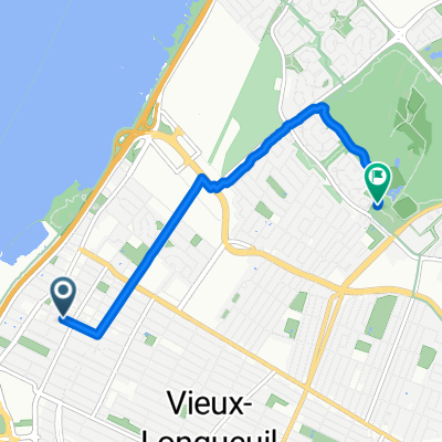
Sortie Laprairie (Piste cyclable) 52 km
A cycling route starting in Longueuil, Quebec, Canada.
Overview
About this route
Gilles pour le CCM Longueuil
(cloned from route 2597696)
- -:--
- Duration
- 49.2 km
- Distance
- 77 m
- Ascent
- 76 m
- Descent
- ---
- Avg. speed
- ---
- Avg. speed

Route quality
Waytypes & surfaces along the route
Waytypes
Cycleway
35.7 km
(73 %)
Quiet road
9.4 km
(19 %)
Surfaces
Paved
45.2 km
(92 %)
Asphalt
44.5 km
(90 %)
Paved (undefined)
0.4 km
(<1 %)
Route highlights
Points of interest along the route
Point of interest after 3.7 km
Point of interest after 21.7 km
Diner
Point of interest after 32.6 km
Parc Radisson
Continue with Bikemap
Use, edit, or download this cycling route
You would like to ride Sortie Laprairie (Piste cyclable) 52 km or customize it for your own trip? Here is what you can do with this Bikemap route:
Free features
- Save this route as favorite or in collections
- Copy & plan your own version of this route
- Sync your route with Garmin or Wahoo
Premium features
Free trial for 3 days, or one-time payment. More about Bikemap Premium.
- Navigate this route on iOS & Android
- Export a GPX / KML file of this route
- Create your custom printout (try it for free)
- Download this route for offline navigation
Discover more Premium features.
Get Bikemap PremiumFrom our community
Other popular routes starting in Longueuil
 Tour MTL 195k
- Distance
- 199.6 km
- Ascent
- 119 m
- Descent
- 117 m
- Location
- Longueuil, Quebec, Canada
 Maine #2
- Distance
- 435 km
- Ascent
- 1,322 m
- Descent
- 1,336 m
- Location
- Longueuil, Quebec, Canada
 Circuit Gilles-Villeneuve (Montréal)
- Distance
- 4.4 km
- Ascent
- 32 m
- Descent
- 31 m
- Location
- Longueuil, Quebec, Canada
 Option 2 (Camping Waterloo)
- Distance
- 191.4 km
- Ascent
- 303 m
- Descent
- 302 m
- Location
- Longueuil, Quebec, Canada
 De 846 Rue Marmier, Longueuil à 846 Rue Marmier, Longueuil
- Distance
- 15 km
- Ascent
- 9 m
- Descent
- 9 m
- Location
- Longueuil, Quebec, Canada
 Longueuil / La Prairie / Sainte-Catherine
- Distance
- 53.9 km
- Ascent
- 136 m
- Descent
- 134 m
- Location
- Longueuil, Quebec, Canada
 Exploration
- Distance
- 27.9 km
- Ascent
- 34 m
- Descent
- 32 m
- Location
- Longueuil, Quebec, Canada
 Route to Parc-Michel-Chartrand
- Distance
- 5.1 km
- Ascent
- 13 m
- Descent
- 0 m
- Location
- Longueuil, Quebec, Canada
Open it in the app