

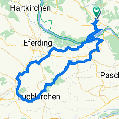
Walding - St. Martin i.M. - Feldkirchen - Walding
A cycling route starting in Walding, Upper Austria, Austria.
Overview
About this route
Schöne Runde mit einer tollen Mountainbike Abfahrt, jedoch auch mit einem Crossbike bewältigbar.
Asphalt: 85%
Weg: 15%
(cloned from route 972616)
- -:--
- Duration
- 38.4 km
- Distance
- 372 m
- Ascent
- 372 m
- Descent
- ---
- Avg. speed
- ---
- Avg. speed
Route quality
Waytypes & surfaces along the route
Waytypes
Quiet road
32.6 km
(85 %)
Track
2.7 km
(7 %)
Surfaces
Paved
4.7 km
(12 %)
Unpaved
2.9 km
(8 %)
Asphalt
4.7 km
(12 %)
Mud
1.8 km
(5 %)
Continue with Bikemap
Use, edit, or download this cycling route
You would like to ride Walding - St. Martin i.M. - Feldkirchen - Walding or customize it for your own trip? Here is what you can do with this Bikemap route:
Free features
- Save this route as favorite or in collections
- Copy & plan your own version of this route
- Sync your route with Garmin or Wahoo
Premium features
Free trial for 3 days, or one-time payment. More about Bikemap Premium.
- Navigate this route on iOS & Android
- Export a GPX / KML file of this route
- Create your custom printout (try it for free)
- Download this route for offline navigation
Discover more Premium features.
Get Bikemap PremiumFrom our community
Other popular routes starting in Walding
 Badesee Mursberg Runde
- Distance
- 24.7 km
- Ascent
- 283 m
- Descent
- 303 m
- Location
- Walding, Upper Austria, Austria
 Rodeltalrunde (E)
- Distance
- 30.3 km
- Ascent
- 824 m
- Descent
- 822 m
- Location
- Walding, Upper Austria, Austria
 Walding nach Mayerhofberg Walding
- Distance
- 63.1 km
- Ascent
- 1,109 m
- Descent
- 1,115 m
- Location
- Walding, Upper Austria, Austria
 Mayer Spargelrunde
- Distance
- 34.6 km
- Ascent
- 90 m
- Descent
- 89 m
- Location
- Walding, Upper Austria, Austria
 Sportpark Neußerling Trops Walding
- Distance
- 55 km
- Ascent
- 749 m
- Descent
- 1,010 m
- Location
- Walding, Upper Austria, Austria
 Sport-Park Pfingstrosen Rundfahrt Home
- Distance
- 62.9 km
- Ascent
- 988 m
- Descent
- 993 m
- Location
- Walding, Upper Austria, Austria
 Landlweg
- Distance
- 44.7 km
- Ascent
- 233 m
- Descent
- 242 m
- Location
- Walding, Upper Austria, Austria
 Sportpark, Lacken, Bad Mühllacken, Sechterberg, Eferding, Walding.
- Distance
- 49.9 km
- Ascent
- 836 m
- Descent
- 851 m
- Location
- Walding, Upper Austria, Austria
Open it in the app