

Mauerpark > Plötzensee > Jungfernheide > HauptBhf. > Invaliedenfriedhof
A cycling route starting in Gesundbrunnen, Land Berlin, Germany.
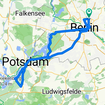
Overview
About this route
Schöne grüne Strecke am Spandauer Schiffahrts-Kanal entlang, von Start Gartenstr., Richtung Westhafen, über Seestr. nach Plötzen See Badeanstalt <> weiter nach Volkspark Jungfernheide und zurück an der Spree entlang über Moabit , Hauptbahnhof und Invaliedenfriedhof. > Ziel Mauerpark Gartenstr.<br />
- -:--
- Duration
- 23.6 km
- Distance
- 51 m
- Ascent
- 50 m
- Descent
- ---
- Avg. speed
- ---
- Avg. speed

Route highlights
Points of interest along the route
Point of interest after 1.8 km
Seller Park Umspannwerg Vattenfall
Point of interest after 3 km
lecker Frühstück im Deichgraf
Point of interest after 5 km
Strandbad Plötzensee
Point of interest after 9.9 km
Strandbad Jungfernheide
Point of interest after 11.7 km
Biergarten
Point of interest after 12.4 km
Wasserturm im Volkspark Jungfernheide
Point of interest after 18.3 km
Restaurantschiff PATIO
Point of interest after 20 km
Ehemaliger Zollpackhof Gartenrestaurante an der Spree
Point of interest after 20 km
Bundeskanzler Amt
Point of interest after 20.2 km
Hauptbahnhof
Point of interest after 21.4 km
Invaliedenfriedhof
Point of interest after 21.6 km
Alter Wachturm DDR
Continue with Bikemap
Use, edit, or download this cycling route
You would like to ride Mauerpark > Plötzensee > Jungfernheide > HauptBhf. > Invaliedenfriedhof or customize it for your own trip? Here is what you can do with this Bikemap route:
Free features
- Save this route as favorite or in collections
- Copy & plan your own version of this route
- Sync your route with Garmin or Wahoo
Premium features
Free trial for 3 days, or one-time payment. More about Bikemap Premium.
- Navigate this route on iOS & Android
- Export a GPX / KML file of this route
- Create your custom printout (try it for free)
- Download this route for offline navigation
Discover more Premium features.
Get Bikemap PremiumFrom our community
Other popular routes starting in Gesundbrunnen
 Prenzlauer Berg <-> Wandlitz
- Distance
- 54.4 km
- Ascent
- 79 m
- Descent
- 79 m
- Location
- Gesundbrunnen, Land Berlin, Germany
 Putbusser Straße, Berlin nach Putbusser Straße, Berlin
- Distance
- 31.1 km
- Ascent
- 541 m
- Descent
- 543 m
- Location
- Gesundbrunnen, Land Berlin, Germany
 12 Strausberg Märkische Schweiz
- Distance
- 55.5 km
- Ascent
- 83 m
- Descent
- 83 m
- Location
- Gesundbrunnen, Land Berlin, Germany
 Prenzlauer Berg, Mühlenbeck, Blankenfelde
- Distance
- 33.8 km
- Ascent
- 44 m
- Descent
- 46 m
- Location
- Gesundbrunnen, Land Berlin, Germany
 Training Nord 60 Lehnitz
- Distance
- 59.3 km
- Ascent
- 166 m
- Descent
- 162 m
- Location
- Gesundbrunnen, Land Berlin, Germany
 Raus aus Berlin, anschlagen und zurück
- Distance
- 96.3 km
- Ascent
- 393 m
- Descent
- 403 m
- Location
- Gesundbrunnen, Land Berlin, Germany
 Berliner Mauerweg Nordroute
- Distance
- 48.5 km
- Ascent
- 123 m
- Descent
- 137 m
- Location
- Gesundbrunnen, Land Berlin, Germany
 Die Eberswalde Extension 2
- Distance
- 119.3 km
- Ascent
- 342 m
- Descent
- 342 m
- Location
- Gesundbrunnen, Land Berlin, Germany
Open it in the app