

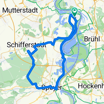
75km; Altrip - Lindemansruhe - Altrip
A cycling route starting in Altrip, Rhineland-Palatinate, Germany.
Overview
About this route
Schöne Tour in die Pfalz
Im wesentlichen Flach bis Erpolzheim dann bis zu 17% Steigung zur Lindemansruhe; komplette Strecke asphaltiert. Hin- und Rückweg sind gleich- -:--
- Duration
- 72.7 km
- Distance
- 424 m
- Ascent
- 423 m
- Descent
- ---
- Avg. speed
- ---
- Avg. speed

Route quality
Waytypes & surfaces along the route
Waytypes
Road
27.7 km
(38 %)
Path
14.9 km
(20 %)
Surfaces
Paved
64.6 km
(89 %)
Unpaved
0.1 km
(<1 %)
Asphalt
56.9 km
(78 %)
Paving stones
6.1 km
(8 %)
Continue with Bikemap
Use, edit, or download this cycling route
You would like to ride 75km; Altrip - Lindemansruhe - Altrip or customize it for your own trip? Here is what you can do with this Bikemap route:
Free features
- Save this route as favorite or in collections
- Copy & plan your own version of this route
- Sync your route with Garmin or Wahoo
Premium features
Free trial for 3 days, or one-time payment. More about Bikemap Premium.
- Navigate this route on iOS & Android
- Export a GPX / KML file of this route
- Create your custom printout (try it for free)
- Download this route for offline navigation
Discover more Premium features.
Get Bikemap PremiumFrom our community
Other popular routes starting in Altrip
 Mannheim -Ketsch-Speyer-Altrip-Mannheim
- Distance
- 60.1 km
- Ascent
- 85 m
- Descent
- 83 m
- Location
- Altrip, Rhineland-Palatinate, Germany
 Mannheim-Neckarau nach Mannheim-Fanklin und zurück
- Distance
- 29.4 km
- Ascent
- 174 m
- Descent
- 174 m
- Location
- Altrip, Rhineland-Palatinate, Germany
 Altrip-Speyer-Dudenhofen-Waldsee-Altrip CLONED FROM ROUTE 21934
- Distance
- 44.3 km
- Ascent
- 50 m
- Descent
- 50 m
- Location
- Altrip, Rhineland-Palatinate, Germany
 Neckarau Altrip Speyer Wörth Straßburg links
- Distance
- 153.3 km
- Ascent
- 111 m
- Descent
- 59 m
- Location
- Altrip, Rhineland-Palatinate, Germany
 Rheinau - Altrip - Brühl
- Distance
- 29.5 km
- Ascent
- 80 m
- Descent
- 80 m
- Location
- Altrip, Rhineland-Palatinate, Germany
 Mannheim - Lampertheim
- Distance
- 41 km
- Ascent
- 37 m
- Descent
- 39 m
- Location
- Altrip, Rhineland-Palatinate, Germany
 Königsstuhl - Wilhelmsfeld - Langenthal - Rothenberg - Rippenweier
- Distance
- 111.4 km
- Ascent
- 1,574 m
- Descent
- 1,576 m
- Location
- Altrip, Rhineland-Palatinate, Germany
 Apfelblütenweg
- Distance
- 46.2 km
- Ascent
- 315 m
- Descent
- 317 m
- Location
- Altrip, Rhineland-Palatinate, Germany
Open it in the app