

0017 Longchamp sur Aujon to Paris
A cycling route starting in Ville-sous-la-Ferté, Grand Est, France.
Overview
About this route
making my way
- -:--
- Duration
- 144.4 km
- Distance
- 437 m
- Ascent
- 570 m
- Descent
- ---
- Avg. speed
- ---
- Max. altitude

Route quality
Waytypes & surfaces along the route
Waytypes
Road
73.7 km
(51 %)
Quiet road
5.8 km
(4 %)
Surfaces
Paved
88.1 km
(61 %)
Asphalt
88.1 km
(61 %)
Undefined
56.3 km
(39 %)
Continue with Bikemap
Use, edit, or download this cycling route
You would like to ride 0017 Longchamp sur Aujon to Paris or customize it for your own trip? Here is what you can do with this Bikemap route:
Free features
- Save this route as favorite or in collections
- Copy & plan your own version of this route
- Split it into stages to create a multi-day tour
- Sync your route with Garmin or Wahoo
Premium features
Free trial for 3 days, or one-time payment. More about Bikemap Premium.
- Navigate this route on iOS & Android
- Export a GPX / KML file of this route
- Create your custom printout (try it for free)
- Download this route for offline navigation
Discover more Premium features.
Get Bikemap PremiumFrom our community
Other popular routes starting in Ville-sous-la-Ferté
 0017 Longchamp sur Aujon to Paris
- Distance
- 144.4 km
- Ascent
- 437 m
- Descent
- 570 m
- Location
- Ville-sous-la-Ferté, Grand Est, France
 De la Ferté à Rue Pierre Marasi 1, Laferté-sur-Aube
- Distance
- 66.1 km
- Ascent
- 662 m
- Descent
- 655 m
- Location
- Ville-sous-la-Ferté, Grand Est, France
 Camino 2015 6b Clairvaux nach Les Riceys
- Distance
- 45.2 km
- Ascent
- 305 m
- Descent
- 314 m
- Location
- Ville-sous-la-Ferté, Grand Est, France
 De Rue du Seilley 5, Ville-sous-la-Ferté à Rue de la Maison Commune 1, Charrey-sur-Seine
- Distance
- 46.2 km
- Ascent
- 616 m
- Descent
- 629 m
- Location
- Ville-sous-la-Ferté, Grand Est, France
 Jakobsweg_8: Clairvaux - Etourvy
- Distance
- 66.3 km
- Ascent
- 846 m
- Descent
- 829 m
- Location
- Ville-sous-la-Ferté, Grand Est, France
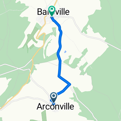 De Rue de l'Abreuvoir à Baroville - Place Mairie
- Distance
- 4.3 km
- Ascent
- 78 m
- Descent
- 141 m
- Location
- Ville-sous-la-Ferté, Grand Est, France
 11 Ville-sous-la-Ferté - Étourvy Jakobsweg
- Distance
- 64.9 km
- Ascent
- 673 m
- Descent
- 673 m
- Location
- Ville-sous-la-Ferté, Grand Est, France
 De Route de Dijon 14, Ville-sous-la-Ferté à Rue du Moulin 3, Charrey-sur-Seine
- Distance
- 31.6 km
- Ascent
- 160 m
- Descent
- 169 m
- Location
- Ville-sous-la-Ferté, Grand Est, France
Open it in the app