
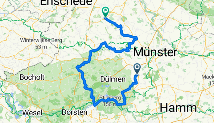
RennFietsen Tour 2011 - 2. Etappe
A cycling route starting in Senden, North Rhine-Westphalia, Germany.
Overview
About this route
- Etappe der RennFietsen Tour 2011
am Freitag, 03. Juni 2011
Start: Senden
Ziel: Metelen
- -:--
- Duration
- 158 km
- Distance
- 347 m
- Ascent
- 349 m
- Descent
- ---
- Avg. speed
- ---
- Avg. speed
Route quality
Waytypes & surfaces along the route
Waytypes
Road
41.2 km
(26 %)
Quiet road
40.5 km
(26 %)
Surfaces
Paved
128.2 km
(81 %)
Unpaved
1.1 km
(<1 %)
Asphalt
121.5 km
(77 %)
Paving stones
6.1 km
(4 %)
Continue with Bikemap
Use, edit, or download this cycling route
You would like to ride RennFietsen Tour 2011 - 2. Etappe or customize it for your own trip? Here is what you can do with this Bikemap route:
Free features
- Save this route as favorite or in collections
- Copy & plan your own version of this route
- Sync your route with Garmin or Wahoo
Premium features
Free trial for 3 days, or one-time payment. More about Bikemap Premium.
- Navigate this route on iOS & Android
- Export a GPX / KML file of this route
- Create your custom printout (try it for free)
- Download this route for offline navigation
Discover more Premium features.
Get Bikemap PremiumFrom our community
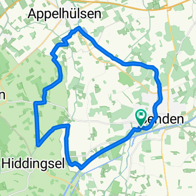
Other popular routes starting in Senden
 von Otti zum Longinusturm
- Distance
- 51.9 km
- Ascent
- 189 m
- Descent
- 192 m
- Location
- Senden, North Rhine-Westphalia, Germany
 Zum Lüdinghausener Schloss
- Distance
- 57.6 km
- Ascent
- 70 m
- Descent
- 70 m
- Location
- Senden, North Rhine-Westphalia, Germany
 Brahmsweg nach L832
- Distance
- 68.1 km
- Ascent
- 171 m
- Descent
- 164 m
- Location
- Senden, North Rhine-Westphalia, Germany
 pättkestour westl. senden
- Distance
- 22.5 km
- Ascent
- 60 m
- Descent
- 60 m
- Location
- Senden, North Rhine-Westphalia, Germany
 CE110916
- Distance
- 22.8 km
- Ascent
- 39 m
- Descent
- 37 m
- Location
- Senden, North Rhine-Westphalia, Germany
 Route nach De Moer
- Distance
- 68.6 km
- Ascent
- 385 m
- Descent
- 350 m
- Location
- Senden, North Rhine-Westphalia, Germany
 MS-Land_51km_Venner Moor
- Distance
- 51.1 km
- Ascent
- 61 m
- Descent
- 65 m
- Location
- Senden, North Rhine-Westphalia, Germany
 Am Dorn nach Drensteinfurt
- Distance
- 29.1 km
- Ascent
- 68 m
- Descent
- 68 m
- Location
- Senden, North Rhine-Westphalia, Germany
Open it in the app