

Altenburg, Rochlitzer Berg, Colditz, Bad Lausik, Neukirchen, Regis, Altenburg,
A cycling route starting in Altenburg, Free State of Thuringia, Germany.
Overview
About this route
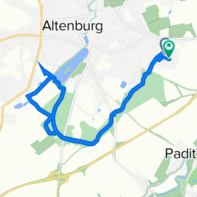
Altenburg, Wilchwitz, Bocka, Dolsenhain, Gnanstein, Kohren Salis. Auf Narsdorfer Str. über Walditz, Niederpickenhain nach Wenigossa. An Hegeteich links, Hegemühle, danach rechts durch Narsdorf zur B175, ca. 1km auf B175 bis zum Abzweig nach rechts zum Rochlitzer Berg und hinauf zum Turrm.
Vom Turm hinunter nach Rochlitz an die Mulde und auf den Mulderadweg über Penna, Kralapp nach Colditz, Mittagspause auf dem Colditzer Markt in angenehmer Kleinstadtatmosphäre. Von Colditz nach Thumirnicht und durch den Colditzer Forst nach Buchheim bzw. Bad Lausik. Nach einer Spitzkehre geht es auf einer ruhigen Landstraße nach Elbisbach und von dort durch Eulatal Prießnitz nach Schönau. Von Schönau führt die Str. am Harthsee vorbei nach Neukirchen. In Neukirchen beginnt der Radweg über Wyhra nachThräna. Von Thräna führt die Route über den Damm durch Regis Breitingen nach Hasselbach. In Hasselbach links abbiegen, um auf den Wiesenradweg zu gelangen, der an der Pleiße entlang nach Trebn führt. In Treben über die Breite Str. zum Mühlgraben und auf den Radweg nach Primmelwitz, von dort auf den RW an der B93 entlang zurück nach Altenburg.- -:--
- Duration
- 97.6 km
- Distance
- 448 m
- Ascent
- 448 m
- Descent
- ---
- Avg. speed
- ---
- Avg. speed
Route quality
Waytypes & surfaces along the route
Waytypes
Road
29.5 km
(30 %)
Quiet road
25.8 km
(26 %)
Surfaces
Paved
68.1 km
(70 %)
Unpaved
12.7 km
(13 %)
Asphalt
65.4 km
(67 %)
Gravel
4.3 km
(4 %)
Continue with Bikemap
Use, edit, or download this cycling route
You would like to ride Altenburg, Rochlitzer Berg, Colditz, Bad Lausik, Neukirchen, Regis, Altenburg, or customize it for your own trip? Here is what you can do with this Bikemap route:
Free features
- Save this route as favorite or in collections
- Copy & plan your own version of this route
- Sync your route with Garmin or Wahoo
Premium features
Free trial for 3 days, or one-time payment. More about Bikemap Premium.
- Navigate this route on iOS & Android
- Export a GPX / KML file of this route
- Create your custom printout (try it for free)
- Download this route for offline navigation
Discover more Premium features.
Get Bikemap PremiumFrom our community
Other popular routes starting in Altenburg
 Altenburg Südost - Sternengarten - Märchenbrunnen - zurück
- Distance
- 8.2 km
- Ascent
- 114 m
- Descent
- 112 m
- Location
- Altenburg, Free State of Thuringia, Germany
 Altenburg Polsterstein
- Distance
- 59 km
- Ascent
- 401 m
- Descent
- 442 m
- Location
- Altenburg, Free State of Thuringia, Germany
 RTF "rund ums Altenburger Land"
- Distance
- 118.1 km
- Ascent
- 726 m
- Descent
- 720 m
- Location
- Altenburg, Free State of Thuringia, Germany
 Planetenweg Maßstab 1 : 900 Mio
- Distance
- 6 km
- Ascent
- 54 m
- Descent
- 90 m
- Location
- Altenburg, Free State of Thuringia, Germany
 NightTrail ABG
- Distance
- 19 km
- Ascent
- 226 m
- Descent
- 226 m
- Location
- Altenburg, Free State of Thuringia, Germany
 Einradtour Altenburg Südost - Stadtwald - Märchenbrunnen
- Distance
- 8 km
- Ascent
- 98 m
- Descent
- 96 m
- Location
- Altenburg, Free State of Thuringia, Germany
 Wenzelstraße 43, Altenburg nach Wenzelstraße 43, Altenburg
- Distance
- 44.5 km
- Ascent
- 248 m
- Descent
- 298 m
- Location
- Altenburg, Free State of Thuringia, Germany
 Schloßberg 1B, Altenburg nach Wenzelstraße 43, Altenburg
- Distance
- 63.8 km
- Ascent
- 685 m
- Descent
- 768 m
- Location
- Altenburg, Free State of Thuringia, Germany
Open it in the app