

Col Hunting Vallée d'Aulpe
A cycling route starting in Féternes, Auvergne-Rhône-Alpes, France.
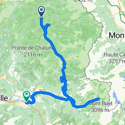
Overview
About this route
A great mountain bike loop that hits 6 cols. Some pushing required as well as hiking trails to link things
- -:--
- Duration
- 40.2 km
- Distance
- 1,462 m
- Ascent
- 1,459 m
- Descent
- ---
- Avg. speed
- ---
- Avg. speed

Route highlights
Points of interest along the route
Point of interest after 11.5 km
Col de Drôline
Point of interest after 14.7 km
Col du Corbier
Point of interest after 18.6 km
Wrong Way!
Point of interest after 22.7 km
Col de Planchamp
Point of interest after 24.9 km
Col de Nicodex
Point of interest after 27 km
Col du Tréchauffée
Point of interest after 30.8 km
Col du Grand Taillet
Continue with Bikemap
Use, edit, or download this cycling route
You would like to ride Col Hunting Vallée d'Aulpe or customize it for your own trip? Here is what you can do with this Bikemap route:
Free features
- Save this route as favorite or in collections
- Copy & plan your own version of this route
- Sync your route with Garmin or Wahoo
Premium features
Free trial for 3 days, or one-time payment. More about Bikemap Premium.
- Navigate this route on iOS & Android
- Export a GPX / KML file of this route
- Create your custom printout (try it for free)
- Download this route for offline navigation
Discover more Premium features.
Get Bikemap PremiumFrom our community
Other popular routes starting in Féternes
 Itinéraire modéré au Mont Béland
- Distance
- 30.4 km
- Ascent
- 651 m
- Descent
- 642 m
- Location
- Féternes, Auvergne-Rhône-Alpes, France
 Tout droit au pied de la dent d’Oche
- Distance
- 49.7 km
- Ascent
- 1,387 m
- Descent
- 1,313 m
- Location
- Féternes, Auvergne-Rhône-Alpes, France
 Pays de Gavot
- Distance
- 48.1 km
- Ascent
- 1,127 m
- Descent
- 1,119 m
- Location
- Féternes, Auvergne-Rhône-Alpes, France
 Col du Grand Taillet Loop
- Distance
- 33.3 km
- Ascent
- 949 m
- Descent
- 950 m
- Location
- Féternes, Auvergne-Rhône-Alpes, France
 Voie comme un escargot dans Féternes
- Distance
- 38.2 km
- Ascent
- 862 m
- Descent
- 858 m
- Location
- Féternes, Auvergne-Rhône-Alpes, France
 Facile à conduire Féternes
- Distance
- 24.7 km
- Ascent
- 310 m
- Descent
- 320 m
- Location
- Féternes, Auvergne-Rhône-Alpes, France
 Cluses J1 Cyclos
- Distance
- 86.3 km
- Ascent
- 1,383 m
- Descent
- 1,601 m
- Location
- Féternes, Auvergne-Rhône-Alpes, France
 Cluses J1 Sportifs
- Distance
- 95.9 km
- Ascent
- 1,756 m
- Descent
- 1,978 m
- Location
- Féternes, Auvergne-Rhône-Alpes, France
Open it in the app