

Taubertal Weikersheim
A cycling route starting in Ohrenbach, Bavaria, Germany.
Overview
About this route
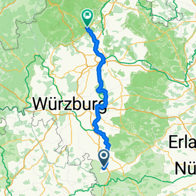
Ohrenbach nach Langensteinach, dem Steinachtal bis Biberehren entlang, im Taubertal auf dem Fahrradweg bis Weikersheim und wieder zurück bis Creglingen . Herrgottskirche in Creglingen. Das Taubertal bis Tauberzell weiter, dann über das Gickelhäusertal bis Ohrenbach
- -:--
- Duration
- 109.5 km
- Distance
- 491 m
- Ascent
- 547 m
- Descent
- ---
- Avg. speed
- ---
- Avg. speed
Route quality
Waytypes & surfaces along the route
Waytypes
Track
64.2 km
(59 %)
Busy road
16.7 km
(15 %)
Surfaces
Paved
86.3 km
(79 %)
Unpaved
5.9 km
(5 %)
Paved (undefined)
44.6 km
(41 %)
Asphalt
38.4 km
(35 %)
Route highlights
Points of interest along the route
Point of interest after 58.4 km
Point of interest after 58.5 km
Continue with Bikemap
Use, edit, or download this cycling route
You would like to ride Taubertal Weikersheim or customize it for your own trip? Here is what you can do with this Bikemap route:
Free features
- Save this route as favorite or in collections
- Copy & plan your own version of this route
- Sync your route with Garmin or Wahoo
Premium features
Free trial for 3 days, or one-time payment. More about Bikemap Premium.
- Navigate this route on iOS & Android
- Export a GPX / KML file of this route
- Create your custom printout (try it for free)
- Download this route for offline navigation
Discover more Premium features.
Get Bikemap PremiumFrom our community
Other popular routes starting in Ohrenbach
 Ohrenbach - Bad Windsheim- Ulsenheim-zurück
- Distance
- 50.6 km
- Ascent
- 272 m
- Descent
- 272 m
- Location
- Ohrenbach, Bavaria, Germany
 Langensteinach
- Distance
- 13.1 km
- Ascent
- 116 m
- Descent
- 120 m
- Location
- Ohrenbach, Bavaria, Germany
 Tagesausflug Iphofen
- Distance
- 74.9 km
- Ascent
- 461 m
- Descent
- 461 m
- Location
- Ohrenbach, Bavaria, Germany
 Schweden 2017-Ohrenbach bis Fulda
- Distance
- 180 km
- Ascent
- 522 m
- Descent
- 604 m
- Location
- Ohrenbach, Bavaria, Germany
 Ohrenbach Equarhofen Aub Ohrenbach
- Distance
- 40.4 km
- Ascent
- 322 m
- Descent
- 322 m
- Location
- Ohrenbach, Bavaria, Germany
 Tagestour 2019
- Distance
- 88.1 km
- Ascent
- 387 m
- Descent
- 468 m
- Location
- Ohrenbach, Bavaria, Germany
 Ohrenbach - Bad Kissingen
- Distance
- 117.4 km
- Ascent
- 266 m
- Descent
- 475 m
- Location
- Ohrenbach, Bavaria, Germany
 Etappe 3
- Distance
- 174.8 km
- Ascent
- 1,630 m
- Descent
- 1,729 m
- Location
- Ohrenbach, Bavaria, Germany
Open it in the app