

CP: Po stopách električky
A cycling route starting in Košice, Košický kraj, Slovak Republic.
Overview
About this route
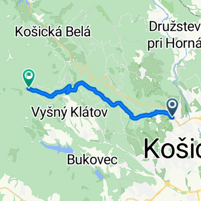
Trasa: Kasárne Kulturpark – Námestie osloboditeľov – Dóm sv. Alžbety – Námestie MM – Havlíčkova – Čermeľ – Havlíčkova – Anička – Mier – Národné námestie – Námestie MM – Námestie osloboditeľov – Kasárne Kulturpark
- -:--
- Duration
- 13.3 km
- Distance
- 80 m
- Ascent
- 80 m
- Descent
- ---
- Avg. speed
- ---
- Avg. speed

Route highlights
Points of interest along the route
Point of interest after 0.8 km
Hlavná ulica a koľajnice
Point of interest after 1.8 km
Námestie MM
Point of interest after 5.2 km
Katka
Point of interest after 6.2 km
Čermeľ a história električky
Point of interest after 9.1 km
Električka na Aničke
Point of interest after 12 km
Električky včera a dnes
Continue with Bikemap
Use, edit, or download this cycling route
You would like to ride CP: Po stopách električky or customize it for your own trip? Here is what you can do with this Bikemap route:
Free features
- Save this route as favorite or in collections
- Copy & plan your own version of this route
- Sync your route with Garmin or Wahoo
Premium features
Free trial for 3 days, or one-time payment. More about Bikemap Premium.
- Navigate this route on iOS & Android
- Export a GPX / KML file of this route
- Create your custom printout (try it for free)
- Download this route for offline navigation
Discover more Premium features.
Get Bikemap PremiumFrom our community
Other popular routes starting in Košice
 Jahodna Singletrack
- Distance
- 6.6 km
- Ascent
- 166 m
- Descent
- 411 m
- Location
- Košice, Košický kraj, Slovak Republic
 Lengthy bike tour through Košice
- Distance
- 36.4 km
- Ascent
- 771 m
- Descent
- 771 m
- Location
- Košice, Košický kraj, Slovak Republic
 2020_Cermel_Lajoska_I
- Distance
- 15.5 km
- Ascent
- 822 m
- Descent
- 143 m
- Location
- Košice, Košický kraj, Slovak Republic
 KE-Ždaňa-Skároš -Hollóháza- hrad Füzér (Hu)
- Distance
- 37.5 km
- Ascent
- 519 m
- Descent
- 352 m
- Location
- Košice, Košický kraj, Slovak Republic
 Košice-Niž.Myšľa -V.Myšľa / vyhliadka
- Distance
- 20 km
- Ascent
- 208 m
- Descent
- 216 m
- Location
- Košice, Košický kraj, Slovak Republic
 Silvestrovská cyklojazda s MedBike_m4y0
- Distance
- 19.9 km
- Ascent
- 235 m
- Descent
- 235 m
- Location
- Košice, Košický kraj, Slovak Republic
 Lajoška 26.6.2010
- Distance
- 43 km
- Ascent
- 851 m
- Descent
- 853 m
- Location
- Košice, Košický kraj, Slovak Republic
 Tahanovce most-Anicka-Cermel-Alpinka-chata Hresna-Anicka-Tahanovce most
- Distance
- 22.5 km
- Ascent
- 406 m
- Descent
- 406 m
- Location
- Košice, Košický kraj, Slovak Republic
Open it in the app