
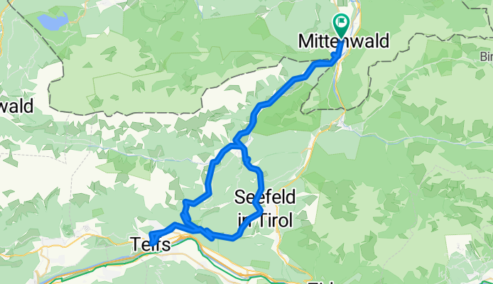
Mittenwald -Leutasch - Telfs - Mittenwald
A cycling route starting in Mittenwald, Bavaria, Germany.
Overview
About this route
Superschöne lanschaftliche Rennradtour durch das Leutaschtal mit kanckigen Rückanstieg nach Leutasch.
Die Tour kann man auch super erweitern in dem es noch weiter ins Inntal geht oder man startet schon in Garmsisch
- -:--
- Duration
- 61.3 km
- Distance
- 1,234 m
- Ascent
- 1,169 m
- Descent
- ---
- Avg. speed
- 1,277 m
- Avg. speed
Route quality
Waytypes & surfaces along the route
Waytypes
Road
33.1 km
(54 %)
Busy road
23.5 km
(38 %)
Surfaces
Paved
57.5 km
(94 %)
Unpaved
0.6 km
(1 %)
Asphalt
57.5 km
(94 %)
Gravel
0.6 km
(1 %)
Undefined
3.1 km
(5 %)
Continue with Bikemap
Use, edit, or download this cycling route
You would like to ride Mittenwald -Leutasch - Telfs - Mittenwald or customize it for your own trip? Here is what you can do with this Bikemap route:
Free features
- Save this route as favorite or in collections
- Copy & plan your own version of this route
- Sync your route with Garmin or Wahoo
Premium features
Free trial for 3 days, or one-time payment. More about Bikemap Premium.
- Navigate this route on iOS & Android
- Export a GPX / KML file of this route
- Create your custom printout (try it for free)
- Download this route for offline navigation
Discover more Premium features.
Get Bikemap PremiumFrom our community
Other popular routes starting in Mittenwald
 kurz Miwa Innsbruck
- Distance
- 50.7 km
- Ascent
- 640 m
- Descent
- 877 m
- Location
- Mittenwald, Bavaria, Germany
 Letzte Etappe Ulm-Gardasee-Ulm
- Distance
- 214.9 km
- Ascent
- 1,305 m
- Descent
- 1,666 m
- Location
- Mittenwald, Bavaria, Germany
 -> Ferein Alm -> Karwendelhaus
- Distance
- 67.7 km
- Ascent
- 1,579 m
- Descent
- 1,576 m
- Location
- Mittenwald, Bavaria, Germany
 Unbenannte Route
- Distance
- 120.7 km
- Ascent
- 1,501 m
- Descent
- 1,727 m
- Location
- Mittenwald, Bavaria, Germany
 Mittenwald_München
- Distance
- 115.5 km
- Ascent
- 214 m
- Descent
- 603 m
- Location
- Mittenwald, Bavaria, Germany
 Karwendelrunde light - Mittenwald - Scharnitz - Karwendelhaus - Hinterriss - Vorderriss - Wallgau
- Distance
- 75.5 km
- Ascent
- 1,530 m
- Descent
- 1,530 m
- Location
- Mittenwald, Bavaria, Germany
 Lautersee-wettersteinalm-ellmau-lautersee
- Distance
- 22.9 km
- Ascent
- 558 m
- Descent
- 558 m
- Location
- Mittenwald, Bavaria, Germany
 Soiern-Runde
- Distance
- 48.6 km
- Ascent
- 945 m
- Descent
- 945 m
- Location
- Mittenwald, Bavaria, Germany
Open it in the app