

Route AT > Alps > Oetztaler
A cycling route starting in Völs, Tyrol, Austria.
Overview
About this route
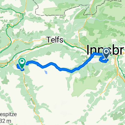
Innsbruck - Brenner - Vipiteno - Jaufenpass - St Leonhard - Timmelsjoch - Oetz - Telfs
- -:--
- Duration
- 203.7 km
- Distance
- 3,948 m
- Ascent
- 3,935 m
- Descent
- ---
- Avg. speed
- ---
- Avg. speed

Continue with Bikemap
Use, edit, or download this cycling route
You would like to ride Route AT > Alps > Oetztaler or customize it for your own trip? Here is what you can do with this Bikemap route:
Free features
- Save this route as favorite or in collections
- Copy & plan your own version of this route
- Sync your route with Garmin or Wahoo
Premium features
Free trial for 3 days, or one-time payment. More about Bikemap Premium.
- Navigate this route on iOS & Android
- Export a GPX / KML file of this route
- Create your custom printout (try it for free)
- Download this route for offline navigation
Discover more Premium features.
Get Bikemap PremiumFrom our community
Other popular routes starting in Völs
 Innsbruck - Scuol
- Distance
- 138.5 km
- Ascent
- 1,050 m
- Descent
- 372 m
- Location
- Völs, Tyrol, Austria
 INNSBRUCK - STERZING (stadtplatz)
- Distance
- 58 km
- Ascent
- 994 m
- Descent
- 621 m
- Location
- Völs, Tyrol, Austria
 Völs-Kematen-Sellrain-Gries-St. Sigmund-Haggen-Kühtai-Ötz-und zurück
- Distance
- 92.1 km
- Ascent
- 3,151 m
- Descent
- 3,140 m
- Location
- Völs, Tyrol, Austria
 Campingplatz Kranebitten - Höttinger Alm
- Distance
- 12.8 km
- Ascent
- 996 m
- Descent
- 122 m
- Location
- Völs, Tyrol, Austria
 von Innsbruck nach Cavaion am Gardasee
- Distance
- 418.8 km
- Ascent
- 2,288 m
- Descent
- 2,648 m
- Location
- Völs, Tyrol, Austria
 Alpequer3
- Distance
- 237.3 km
- Ascent
- 4,005 m
- Descent
- 4,180 m
- Location
- Völs, Tyrol, Austria
 Kühtai Sattel 2009
- Distance
- 55.3 km
- Ascent
- 1,805 m
- Descent
- 1,740 m
- Location
- Völs, Tyrol, Austria
 Innsbruck Route Großer Solberg
- Distance
- 17.4 km
- Ascent
- 2,216 m
- Descent
- 2,214 m
- Location
- Völs, Tyrol, Austria
Open it in the app