Premium Badge Download on the App Store Get it on Google Play Turn-by-turn Navigation Offline Maps Bike Type Optimized Routing Premium Maps Custom Bike Computer Export Routes Route Previews Fall Detection Premium Support

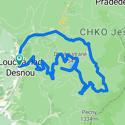
Cycling Route in Loučná nad Desnou, Olomoucký kraj, Czechia

Góry Opawskie 27

0
Open this route in the Bikemap app

Open this route in the Bikemap app

Open this route in Bikemap Web

Open this route in Bikemap Web

13 km
Distance
800 m
Ascent
82 m
Descent
-:-- h
Duration
-- km/h
Avg. Speed
--- m
Max. Elevation

About This Route

Dlouhé Stráně - elektrownia szczytowo-pompowa została zbudowana w latach 1978-1996 w dolinie rzeki Divoká Desná. Większa część została umieszczona pod ziemią i dzięki temu nie psuje w większym stopniu krajobrazu Jeseników. Górny zbiornik jest położony na wysokości 1350 m n.p.m. i szczyci się swoimi rozmiarami: 700 m x 300 m. Różnica poziomów pomiędzy górnym i dolnym zbiornikiem jak również moc urządzeń należą do największych w Europie Środkowej.<span style="font-family: Arial, Helvetica, sans-serif; background-color: rgb(210, 229, 234);">Środkowej.</span>

This cycling route is ideal for: MTB

You will cycle on the following surfaces: Paved

Customize this cycling route with the Bikemap route planner.

Make it yours!

Did you know? You can use this route as a template in our cycling route planner if you don't wish to start from scratch. Customize it based on your needs to plan your perfect cycling tour.

Open it in the app