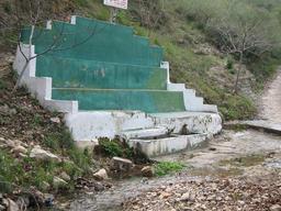
Sierra de Chiva
A cycling route starting in Chiva, Valencia, Spain.
Overview
About this route
Ruta por la sierra de Chiva.
Empezando en la estación de tren subiendo por el Corral del Gato hasta la Nevera, pasando por la Loma del Cuco y llegando a la fuente la Alhondiga para bajar despues hasta la fuente Enebro y bajando por la cuesta del Tendero hasta llegar a la Fuente de Vista Alegre y al punto de inicio de esta ruta.
- -:--
- Duration
- 40.6 km
- Distance
- 747 m
- Ascent
- 748 m
- Descent
- ---
- Avg. speed
- ---
- Avg. speed
Route highlights
Points of interest along the route

Point of interest after 24.3 km
Fuente la Alhóndiga

Point of interest after 26.6 km
Fuente Enebro

Point of interest after 34.6 km
Fuente Incolla

Point of interest after 40 km
Fuente Vista Alegre, actualmente no tiene agua y no se puede beber.
Continue with Bikemap
Use, edit, or download this cycling route
You would like to ride Sierra de Chiva or customize it for your own trip? Here is what you can do with this Bikemap route:
Free features
- Save this route as favorite or in collections
- Copy & plan your own version of this route
- Sync your route with Garmin or Wahoo
Premium features
Free trial for 3 days, or one-time payment. More about Bikemap Premium.
- Navigate this route on iOS & Android
- Export a GPX / KML file of this route
- Create your custom printout (try it for free)
- Download this route for offline navigation
Discover more Premium features.
Get Bikemap PremiumFrom our community
Other popular routes starting in Chiva
 Chiva-Serretilla pozo rosemblanc Incoya Chiva
- Distance
- 28 km
- Ascent
- 552 m
- Descent
- 552 m
- Location
- Chiva, Valencia, Spain
 Sierra de Chiva
- Distance
- 40.6 km
- Ascent
- 747 m
- Descent
- 748 m
- Location
- Chiva, Valencia, Spain
 Chiva-La Portera-Chiva
- Distance
- 121.4 km
- Ascent
- 1,008 m
- Descent
- 1,012 m
- Location
- Chiva, Valencia, Spain
 chiva-oratillos-fte. la peraleja-fte. la puerca-fte. la vallesa-selletilla-chiva
- Distance
- 65 km
- Ascent
- 923 m
- Descent
- 923 m
- Location
- Chiva, Valencia, Spain
 Chiva 2
- Distance
- 39.9 km
- Ascent
- 760 m
- Descent
- 758 m
- Location
- Chiva, Valencia, Spain
 Etapa1 Chiva-Aguilas
- Distance
- 184.2 km
- Ascent
- 1,413 m
- Descent
- 1,112 m
- Location
- Chiva, Valencia, Spain
 Chiva-oratillos-serretilla-chiva
- Distance
- 39.3 km
- Ascent
- 747 m
- Descent
- 747 m
- Location
- Chiva, Valencia, Spain
 Sierra Chiva Pico Hierbas IBP100
- Distance
- 52.5 km
- Ascent
- 959 m
- Descent
- 957 m
- Location
- Chiva, Valencia, Spain
Open it in the app


