

28072014 ED0 Dopplerhütte
A cycling route starting in Wördern, Lower Austria, Austria.
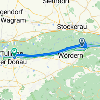
Overview
About this route
Dopplerhütte rauf mit Full bis Oberkirchbach 100 auf 65% daheim 71
- -:--
- Duration
- 22.2 km
- Distance
- 425 m
- Ascent
- 422 m
- Descent
- ---
- Avg. speed
- ---
- Avg. speed
Route quality
Waytypes & surfaces along the route
Waytypes
Road
10.7 km
(48 %)
Busy road
8.2 km
(37 %)
Surfaces
Paved
18.9 km
(85 %)
Asphalt
18.9 km
(85 %)
Undefined
3.3 km
(15 %)
Continue with Bikemap
Use, edit, or download this cycling route
You would like to ride 28072014 ED0 Dopplerhütte or customize it for your own trip? Here is what you can do with this Bikemap route:
Free features
- Save this route as favorite or in collections
- Copy & plan your own version of this route
- Sync your route with Garmin or Wahoo
Premium features
Free trial for 3 days, or one-time payment. More about Bikemap Premium.
- Navigate this route on iOS & Android
- Export a GPX / KML file of this route
- Create your custom printout (try it for free)
- Download this route for offline navigation
Discover more Premium features.
Get Bikemap PremiumFrom our community
Other popular routes starting in Wördern
 Heiligenstadt_St.AndräWördner_Donauroute_2016
- Distance
- 22.5 km
- Ascent
- 79 m
- Descent
- 88 m
- Location
- Wördern, Lower Austria, Austria
 STIFTS - HAGENBACH - KOMBITOUR
- Distance
- 57.8 km
- Ascent
- 762 m
- Descent
- 761 m
- Location
- Wördern, Lower Austria, Austria
 St. Andrä-Strecke
- Distance
- 16.9 km
- Ascent
- 437 m
- Descent
- 437 m
- Location
- Wördern, Lower Austria, Austria
 Greifenstein Bergtraining Hadersfeld
- Distance
- 3 km
- Ascent
- 280 m
- Descent
- 68 m
- Location
- Wördern, Lower Austria, Austria
 Route nach Auhofstraße 4, 3423 Sankt Andrä-Wördern
- Distance
- 63.7 km
- Ascent
- 693 m
- Descent
- 692 m
- Location
- Wördern, Lower Austria, Austria
 STIFTSTOUR
- Distance
- 35.9 km
- Ascent
- 434 m
- Descent
- 435 m
- Location
- Wördern, Lower Austria, Austria
 erste Tour
- Distance
- 15.3 km
- Ascent
- 445 m
- Descent
- 331 m
- Location
- Wördern, Lower Austria, Austria
 Recorded via Apple Watch on 16. Feb at 12:42
- Distance
- 17.1 km
- Ascent
- 13 m
- Descent
- 10 m
- Location
- Wördern, Lower Austria, Austria
Open it in the app