

Radel-Thon (GPS)
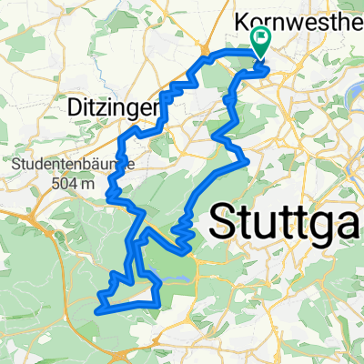
A cycling route starting in Kornwestheim, Baden-Württemberg, Germany.
Overview
About this route
exakt vermessene Strecke des Radel-Thon (mit GPS abgefahren)
hauptsächlich Wald- und Feldwege mit Schotter
Ausschilderungen sind - Stand 27. Mai 2012 - alle vorhanden, wenn auch nicht immer gut zu erkennen (z.B. etwas verdeckt durch Laub)
(cloned from route 1603072)
- -:--
- Duration
- 79.6 km
- Distance
- 583 m
- Ascent
- 583 m
- Descent
- ---
- Avg. speed
- ---
- Avg. speed

Route quality
Waytypes & surfaces along the route
Waytypes
Track
34.8 km
(44 %)
Quiet road
14.5 km
(18 %)
Surfaces
Paved
49.6 km
(62 %)
Unpaved
23.5 km
(29 %)
Asphalt
48.3 km
(61 %)
Loose gravel
13.9 km
(17 %)
Continue with Bikemap
Use, edit, or download this cycling route
You would like to ride Radel-Thon (GPS) or customize it for your own trip? Here is what you can do with this Bikemap route:
Free features
- Save this route as favorite or in collections
- Copy & plan your own version of this route
- Sync your route with Garmin or Wahoo
Premium features
Free trial for 3 days, or one-time payment. More about Bikemap Premium.
- Navigate this route on iOS & Android
- Export a GPX / KML file of this route
- Create your custom printout (try it for free)
- Download this route for offline navigation
Discover more Premium features.
Get Bikemap PremiumFrom our community
Other popular routes starting in Kornwestheim
 Rund um Münchingen
- Distance
- 29.7 km
- Ascent
- 245 m
- Descent
- 231 m
- Location
- Kornwestheim, Baden-Württemberg, Germany
 Neckar- Bietigheim tour
- Distance
- 59.9 km
- Ascent
- 326 m
- Descent
- 326 m
- Location
- Kornwestheim, Baden-Württemberg, Germany
 Katzenbacher Hof, Solitude, Grüner Heiner
- Distance
- 53.8 km
- Ascent
- 541 m
- Descent
- 541 m
- Location
- Kornwestheim, Baden-Württemberg, Germany
 "Kleiner" Thon
- Distance
- 61.3 km
- Ascent
- 514 m
- Descent
- 514 m
- Location
- Kornwestheim, Baden-Württemberg, Germany
 Kornwestheim - Neckartal - Bottwartal - Neckartal - Kornwestheim
- Distance
- 91.8 km
- Ascent
- 389 m
- Descent
- 389 m
- Location
- Kornwestheim, Baden-Württemberg, Germany
 Kornwestheim - Korntal-Münchingen
- Distance
- 8.4 km
- Ascent
- 67 m
- Descent
- 54 m
- Location
- Kornwestheim, Baden-Württemberg, Germany
 L1144 86, Kornwestheim nach Kernenstraße 15, Waiblingen
- Distance
- 57.4 km
- Ascent
- 576 m
- Descent
- 634 m
- Location
- Kornwestheim, Baden-Württemberg, Germany
 Kornwestheim - Bärenschlößle -Runde
- Distance
- 43.8 km
- Ascent
- 347 m
- Descent
- 347 m
- Location
- Kornwestheim, Baden-Württemberg, Germany
Open it in the app