

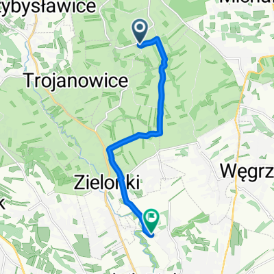
Wola Zachariaszowska- Witkowice
A cycling route starting in Zielonki, Lesser Poland Voivodeship, Poland.
Overview
About this route
Easy trail, without significant elevation changes, mainly along paved and dirt roads, featuring scenic qualities.
- -:--
- Duration
- 7 km
- Distance
- 31 m
- Ascent
- 107 m
- Descent
- ---
- Avg. speed
- ---
- Max. altitude
Route highlights
Points of interest along the route

Point of interest after 3.2 km
Punkt spoczynkowy
Continue with Bikemap
Use, edit, or download this cycling route
You would like to ride Wola Zachariaszowska- Witkowice or customize it for your own trip? Here is what you can do with this Bikemap route:
Free features
- Save this route as favorite or in collections
- Copy & plan your own version of this route
- Sync your route with Garmin or Wahoo
Premium features
Free trial for 3 days, or one-time payment. More about Bikemap Premium.
- Navigate this route on iOS & Android
- Export a GPX / KML file of this route
- Create your custom printout (try it for free)
- Download this route for offline navigation
Discover more Premium features.
Get Bikemap PremiumFrom our community
Other popular routes starting in Zielonki
 Dolina Prądnika
- Distance
- 44.4 km
- Ascent
- 421 m
- Descent
- 421 m
- Location
- Zielonki, Lesser Poland Voivodeship, Poland
 pętelka treningowa
- Distance
- 47.6 km
- Ascent
- 634 m
- Descent
- 636 m
- Location
- Zielonki, Lesser Poland Voivodeship, Poland
 Wola Zachariaszowska- Witkowice
- Distance
- 7 km
- Ascent
- 31 m
- Descent
- 107 m
- Location
- Zielonki, Lesser Poland Voivodeship, Poland
 Szlak czerwony w gminie zielonki
- Distance
- 32.6 km
- Ascent
- 345 m
- Descent
- 345 m
- Location
- Zielonki, Lesser Poland Voivodeship, Poland
 SkalaPetelka
- Distance
- 40.7 km
- Ascent
- 275 m
- Descent
- 276 m
- Location
- Zielonki, Lesser Poland Voivodeship, Poland
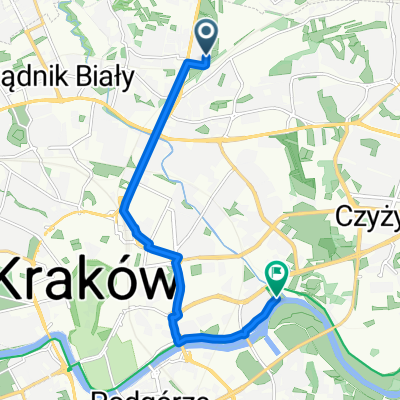 Route to Krakow
- Distance
- 8.9 km
- Ascent
- 8 m
- Descent
- 39 m
- Location
- Zielonki, Lesser Poland Voivodeship, Poland
 Zimowo super zamrożone.
- Distance
- 54 km
- Ascent
- 489 m
- Descent
- 487 m
- Location
- Zielonki, Lesser Poland Voivodeship, Poland
 Zielonki (szlak okrężny)
- Distance
- 32.6 km
- Ascent
- 363 m
- Descent
- 365 m
- Location
- Zielonki, Lesser Poland Voivodeship, Poland
Open it in the app