

Eglofstal - Oberstaufen - Immenstadt - Nesselwang - Hopferau (Bodensee-Königsee-Radweg)
A cycling route starting in Heimenkirch, Bavaria, Germany.
Overview
About this route
Dies ist die 4. Etappe meiner Sommer-Radltour durch Süddeutschland. Die Route führt über Landstrassen, größtenteils asphaltierten oder betonierten Feld- bzw. Radwegen, es kommen aber auch grob geschotterte Feldwege vor.<br /> <br /> 1. Etappe: Unterpleichfeld - Ellwangen<br /> <br /> 2. Etappe: Ellwangen - Biberach a. d. Riß<br /> <br /> 3. Etappe: Biberach a. d. Riß - Eglofstal<br /> <br /> 4. Etappe: Eglofstal - Hopferau<br /> <br /> 5. Etappe: Hopferau - Augsburg<br /> <br /> 6. Etappe: Augsburg - Donauwörth<br /> <br /> 7. Etappe: Donauwörth - Feuchtwangen<br /> <br /> 8. Etappe: Feuchtwangen - Grünsfeld<br /> <br /> 9. Etappe: Grünsfeld - Unterpleichfeld
- -:--
- Duration
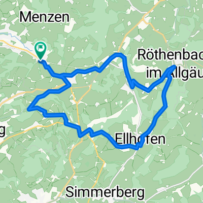
- 86.5 km
- Distance
- 753 m
- Ascent
- 529 m
- Descent
- ---
- Avg. speed
- ---
- Avg. speed
Route quality
Waytypes & surfaces along the route
Waytypes
Quiet road
49.4 km
(57 %)
Road
9.6 km
(11 %)
Surfaces
Paved
82.7 km
(96 %)
Unpaved
2.2 km
(2 %)
Asphalt
80.9 km
(94 %)
Paved (undefined)
1.8 km
(2 %)
Continue with Bikemap
Use, edit, or download this cycling route
You would like to ride Eglofstal - Oberstaufen - Immenstadt - Nesselwang - Hopferau (Bodensee-Königsee-Radweg) or customize it for your own trip? Here is what you can do with this Bikemap route:
Free features
- Save this route as favorite or in collections
- Copy & plan your own version of this route
- Sync your route with Garmin or Wahoo
Premium features
Free trial for 3 days, or one-time payment. More about Bikemap Premium.
- Navigate this route on iOS & Android
- Export a GPX / KML file of this route
- Create your custom printout (try it for free)
- Download this route for offline navigation
Discover more Premium features.
Get Bikemap PremiumFrom our community
Other popular routes starting in Heimenkirch
 ALLGÄU 002: Eglofser Allgäurunde
- Distance
- 36 km
- Ascent
- 399 m
- Descent
- 400 m
- Location
- Heimenkirch, Bavaria, Germany
 Sylvia
- Distance
- 61.9 km
- Ascent
- 270 m
- Descent
- 500 m
- Location
- Heimenkirch, Bavaria, Germany
 Westallgäu Ost
- Distance
- 54.5 km
- Ascent
- 776 m
- Descent
- 774 m
- Location
- Heimenkirch, Bavaria, Germany
 Bodensee mittel
- Distance
- 214.5 km
- Ascent
- 433 m
- Descent
- 433 m
- Location
- Heimenkirch, Bavaria, Germany
 Ellhofen - Weiler
- Distance
- 16.9 km
- Ascent
- 268 m
- Descent
- 268 m
- Location
- Heimenkirch, Bavaria, Germany
 Kemptener Straße 17, Heimenkirch nach B32 5, Opfenbach
- Distance
- 7.4 km
- Ascent
- 19 m
- Descent
- 171 m
- Location
- Heimenkirch, Bavaria, Germany
 Aufnahme vom 27.05.2016, 13:36
- Distance
- 29.4 km
- Ascent
- 481 m
- Descent
- 824 m
- Location
- Heimenkirch, Bavaria, Germany
 WG-LI-Weiler-Ellhofen-Gest-Eisen
- Distance
- 27 km
- Ascent
- 481 m
- Descent
- 554 m
- Location
- Heimenkirch, Bavaria, Germany
Open it in the app