

Greifensee/Fork Hill Loop
A cycling route starting in Wallisellen, Canton of Zurich, Switzerland.
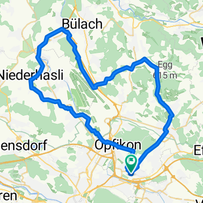
Overview
About this route
Hilly
- -:--
- Duration
- 39.2 km
- Distance
- 351 m
- Ascent
- 351 m
- Descent
- ---
- Avg. speed
- ---
- Avg. speed
Route quality
Waytypes & surfaces along the route
Waytypes
Busy road
17.8 km
(45 %)
Path
8.6 km
(22 %)
Surfaces
Paved
38.8 km
(99 %)
Unpaved
0.2 km
(<1 %)
Asphalt
38 km
(97 %)
Concrete
0.7 km
(2 %)
Continue with Bikemap
Use, edit, or download this cycling route
You would like to ride Greifensee/Fork Hill Loop or customize it for your own trip? Here is what you can do with this Bikemap route:
Free features
- Save this route as favorite or in collections
- Copy & plan your own version of this route
- Sync your route with Garmin or Wahoo
Premium features
Free trial for 3 days, or one-time payment. More about Bikemap Premium.
- Navigate this route on iOS & Android
- Export a GPX / KML file of this route
- Create your custom printout (try it for free)
- Download this route for offline navigation
Discover more Premium features.
Get Bikemap PremiumFrom our community
Other popular routes starting in Wallisellen
 walissellen-Dambenois
- Distance
- 198.6 km
- Ascent
- 889 m
- Descent
- 980 m
- Location
- Wallisellen, Canton of Zurich, Switzerland
 Route 1 Zurich Lake 14.03.2015
- Distance
- 86.3 km
- Ascent
- 573 m
- Descent
- 573 m
- Location
- Wallisellen, Canton of Zurich, Switzerland
 BODENSEE-TOUR 2015, Tag 1/6
- Distance
- 40.1 km
- Ascent
- 423 m
- Descent
- 406 m
- Location
- Wallisellen, Canton of Zurich, Switzerland
 Pfüngen - Brutten
- Distance
- 40.3 km
- Ascent
- 471 m
- Descent
- 471 m
- Location
- Wallisellen, Canton of Zurich, Switzerland
 Wallisellen-Brugg short
- Distance
- 35 km
- Ascent
- 108 m
- Descent
- 190 m
- Location
- Wallisellen, Canton of Zurich, Switzerland
 Wallisellen-Brugg
- Distance
- 44.8 km
- Ascent
- 190 m
- Descent
- 272 m
- Location
- Wallisellen, Canton of Zurich, Switzerland
 walissellen-Dambenois
- Distance
- 198.6 km
- Ascent
- 901 m
- Descent
- 997 m
- Location
- Wallisellen, Canton of Zurich, Switzerland
 Airport loop
- Distance
- 42.3 km
- Ascent
- 332 m
- Descent
- 331 m
- Location
- Wallisellen, Canton of Zurich, Switzerland
Open it in the app