

Eckkopf - Pechsteinkopf
A cycling route starting in Niederkirchen bei Deidesheim, Rhineland-Palatinate, Germany.
Overview
About this route
TEASI track vom 20.08.2014
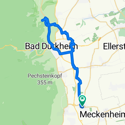
Über den Wallberg und den weißen Stich zum Eckkopf und über den Pechsteinkopf und Forst nach Niederkirchen. Obwohl es breite Fahrwege sind, sind diese teilweise sehr stark zugewachsen.- -:--
- Duration
- 24.4 km
- Distance
- 444 m
- Ascent
- 443 m
- Descent
- ---
- Avg. speed
- ---
- Avg. speed

Route quality
Waytypes & surfaces along the route
Waytypes
Track
21.8 km
(89 %)
Quiet road
1.2 km
(5 %)
Surfaces
Paved
8.5 km
(35 %)
Unpaved
15.2 km
(62 %)
Gravel
8.4 km
(35 %)
Ground
6.2 km
(25 %)
Continue with Bikemap
Use, edit, or download this cycling route
You would like to ride Eckkopf - Pechsteinkopf or customize it for your own trip? Here is what you can do with this Bikemap route:
Free features
- Save this route as favorite or in collections
- Copy & plan your own version of this route
- Sync your route with Garmin or Wahoo
Premium features
Free trial for 3 days, or one-time payment. More about Bikemap Premium.
- Navigate this route on iOS & Android
- Export a GPX / KML file of this route
- Create your custom printout (try it for free)
- Download this route for offline navigation
Discover more Premium features.
Get Bikemap PremiumFrom our community
Other popular routes starting in Niederkirchen bei Deidesheim
 Michaelskapelle - Heidenlöcher - Am Weißenstich
- Distance
- 28.1 km
- Ascent
- 574 m
- Descent
- 574 m
- Location
- Niederkirchen bei Deidesheim, Rhineland-Palatinate, Germany
 Weißer Stich - Mühltal
- Distance
- 24.2 km
- Ascent
- 401 m
- Descent
- 403 m
- Location
- Niederkirchen bei Deidesheim, Rhineland-Palatinate, Germany
 Niederkrichen - Bad Dürkheim.gpx
- Distance
- 16.6 km
- Ascent
- 55 m
- Descent
- 52 m
- Location
- Niederkirchen bei Deidesheim, Rhineland-Palatinate, Germany
 Haardt - Weinbiet - Haßloch
- Distance
- 41.3 km
- Ascent
- 506 m
- Descent
- 506 m
- Location
- Niederkirchen bei Deidesheim, Rhineland-Palatinate, Germany
 Michaelskappele - Wallberg - Mühltal
- Distance
- 21.4 km
- Ascent
- 268 m
- Descent
- 271 m
- Location
- Niederkirchen bei Deidesheim, Rhineland-Palatinate, Germany
 Kreuz und Quer durch die Weinberge
- Distance
- 22.1 km
- Ascent
- 165 m
- Descent
- 165 m
- Location
- Niederkirchen bei Deidesheim, Rhineland-Palatinate, Germany
 Am Weißentsich - Wachenheim
- Distance
- 29.6 km
- Ascent
- 487 m
- Descent
- 487 m
- Location
- Niederkirchen bei Deidesheim, Rhineland-Palatinate, Germany
 Niederkirchen - Leistadt
- Distance
- 25.4 km
- Ascent
- 201 m
- Descent
- 198 m
- Location
- Niederkirchen bei Deidesheim, Rhineland-Palatinate, Germany
Open it in the app