

Madingley, Dry Drayton
A cycling route starting in Comberton, England, United Kingdom.
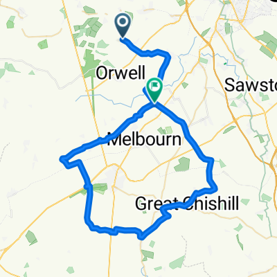
Overview
About this route
Highfields Caldecote, Madingley, Dry Drayton
- -:--
- Duration
- 13.9 km
- Distance
- 60 m
- Ascent
- 61 m
- Descent
- ---
- Avg. speed
- ---
- Avg. speed
Route quality
Waytypes & surfaces along the route
Waytypes
Road
12 km
(87 %)
Pedestrian area
1.1 km
(8 %)
Surfaces
Paved
1.1 km
(8 %)
Asphalt
1.1 km
(8 %)
Undefined
12.8 km
(92 %)
Continue with Bikemap
Use, edit, or download this cycling route
You would like to ride Madingley, Dry Drayton or customize it for your own trip? Here is what you can do with this Bikemap route:
Free features
- Save this route as favorite or in collections
- Copy & plan your own version of this route
- Sync your route with Garmin or Wahoo
Premium features
Free trial for 3 days, or one-time payment. More about Bikemap Premium.
- Navigate this route on iOS & Android
- Export a GPX / KML file of this route
- Create your custom printout (try it for free)
- Download this route for offline navigation
Discover more Premium features.
Get Bikemap PremiumFrom our community
Other popular routes starting in Comberton
 Highfields Caldecote to St Ives - route 1
- Distance
- 17.8 km
- Ascent
- 4 m
- Descent
- 67 m
- Location
- Comberton, England, United Kingdom
 Highfields Caldecote to Trumpington
- Distance
- 14.9 km
- Ascent
- 30 m
- Descent
- 81 m
- Location
- Comberton, England, United Kingdom
 Madingley, Dry Drayton
- Distance
- 13.9 km
- Ascent
- 60 m
- Descent
- 61 m
- Location
- Comberton, England, United Kingdom
 Eversden Barkway Shepreth
- Distance
- 54.7 km
- Ascent
- 328 m
- Descent
- 340 m
- Location
- Comberton, England, United Kingdom
 Highfields Caldecote to Caxton
- Distance
- 19.4 km
- Ascent
- 62 m
- Descent
- 62 m
- Location
- Comberton, England, United Kingdom
 st ives & Huntingdon
- Distance
- 51.3 km
- Ascent
- 160 m
- Descent
- 160 m
- Location
- Comberton, England, United Kingdom
 Highfields Caldecote to Coton
- Distance
- 22.4 km
- Ascent
- 74 m
- Descent
- 76 m
- Location
- Comberton, England, United Kingdom
 Eversdens
- Distance
- 22.6 km
- Ascent
- 108 m
- Descent
- 106 m
- Location
- Comberton, England, United Kingdom
Open it in the app