
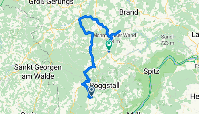
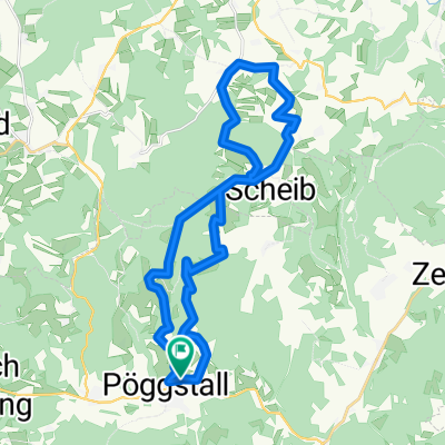
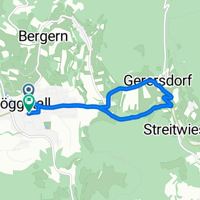
Ins Waldviertler Hochland
A cycling route starting in Pöggstall, Lower Austria, Austria.
Overview
About this route
Steiler Anstieg von Laimbach aus - etwas flacher übers Hcohland - hinunter zur Burg Rappottenstein und ins Kamptal - wieder hinaus, und oben ein wenig hin und her bis Ottenschlag
- -:--
- Duration
- 73.1 km
- Distance
- 991 m
- Ascent
- 864 m
- Descent
- ---
- Avg. speed
- ---
- Avg. speed
Route quality
Waytypes & surfaces along the route
Waytypes
Busy road
34.1 km
(47 %)
Road
28.1 km
(38 %)
Surfaces
Paved
19.7 km
(27 %)
Unpaved
2.9 km
(4 %)
Asphalt
19.7 km
(27 %)
Gravel
2.3 km
(3 %)
Continue with Bikemap
Use, edit, or download this cycling route
You would like to ride Ins Waldviertler Hochland or customize it for your own trip? Here is what you can do with this Bikemap route:
Free features
- Save this route as favorite or in collections
- Copy & plan your own version of this route
- Sync your route with Garmin or Wahoo
Premium features
Free trial for 3 days, or one-time payment. More about Bikemap Premium.
- Navigate this route on iOS & Android
- Export a GPX / KML file of this route
- Create your custom printout (try it for free)
- Download this route for offline navigation
Discover more Premium features.
Get Bikemap PremiumFrom our community
Other popular routes starting in Pöggstall
 Tavernplatz 5, Pöggstall nach Zoterhofstraße 3, Hofamt Priel
- Distance
- 41 km
- Ascent
- 484 m
- Descent
- 715 m
- Location
- Pöggstall, Lower Austria, Austria
 höhenmeter
- Distance
- 12.4 km
- Ascent
- 492 m
- Descent
- 119 m
- Location
- Pöggstall, Lower Austria, Austria
 MTB 1
MTB 1- Distance
- 27.9 km
- Ascent
- 581 m
- Descent
- 584 m
- Location
- Pöggstall, Lower Austria, Austria
 Kombitour 8 & 17
- Distance
- 38 km
- Ascent
- 1,050 m
- Descent
- 1,052 m
- Location
- Pöggstall, Lower Austria, Austria
 2022_Pöggstall-Molln
- Distance
- 134.6 km
- Ascent
- 1,676 m
- Descent
- 1,673 m
- Location
- Pöggstall, Lower Austria, Austria
 Route in Pöggstall
- Distance
- 5.9 km
- Ascent
- 115 m
- Descent
- 120 m
- Location
- Pöggstall, Lower Austria, Austria
 Route in Pöggstall Erste
- Distance
- 30.9 km
- Ascent
- 558 m
- Descent
- 569 m
- Location
- Pöggstall, Lower Austria, Austria
 Ins Waldviertler Hochland
- Distance
- 73.1 km
- Ascent
- 991 m
- Descent
- 864 m
- Location
- Pöggstall, Lower Austria, Austria
Open it in the app