

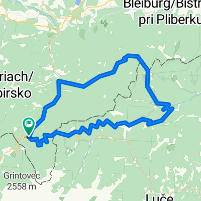
Luschaalmrunde
A cycling route starting in Bad Eisenkappel, Carinthia, Austria.
Overview
About this route
<p>Panorama route</p>
Translated, show original (German)(cloned from route 2317203)
- -:--
- Duration
- 61.7 km
- Distance
- 1,799 m
- Ascent
- 1,797 m
- Descent
- ---
- Avg. speed
- ---
- Max. altitude
Route quality
Waytypes & surfaces along the route
Waytypes
Road
38.2 km
(62 %)
Quiet road
9.2 km
(15 %)
Surfaces
Paved
20.3 km
(33 %)
Unpaved
28.4 km
(46 %)
Asphalt
20.3 km
(33 %)
Gravel
17.3 km
(28 %)
Continue with Bikemap
Use, edit, or download this cycling route
You would like to ride Luschaalmrunde or customize it for your own trip? Here is what you can do with this Bikemap route:
Free features
- Save this route as favorite or in collections
- Copy & plan your own version of this route
- Sync your route with Garmin or Wahoo
Premium features
Free trial for 3 days, or one-time payment. More about Bikemap Premium.
- Navigate this route on iOS & Android
- Export a GPX / KML file of this route
- Create your custom printout (try it for free)
- Download this route for offline navigation
Discover more Premium features.
Get Bikemap PremiumFrom our community
Other popular routes starting in Bad Eisenkappel
 bad eisenkappel
- Distance
- 135.9 km
- Ascent
- 788 m
- Descent
- 798 m
- Location
- Bad Eisenkappel, Carinthia, Austria
 Krožna KP po meji
- Distance
- 47.1 km
- Ascent
- 2,392 m
- Descent
- 2,392 m
- Location
- Bad Eisenkappel, Carinthia, Austria
 Vellach 9 nach Vellach 9
- Distance
- 20.9 km
- Ascent
- 695 m
- Descent
- 677 m
- Location
- Bad Eisenkappel, Carinthia, Austria
 Turnersee-Seebergsattel-Paulitsch
- Distance
- 116.6 km
- Ascent
- 1,821 m
- Descent
- 1,830 m
- Location
- Bad Eisenkappel, Carinthia, Austria
 09 Seebergsattel
- Distance
- 98.2 km
- Ascent
- 1,503 m
- Descent
- 1,919 m
- Location
- Bad Eisenkappel, Carinthia, Austria
 Paulitsch- u. Seebergsattel
- Distance
- 59.2 km
- Ascent
- 3,080 m
- Descent
- 3,083 m
- Location
- Bad Eisenkappel, Carinthia, Austria
 Koroska-panoramska
- Distance
- 62.6 km
- Ascent
- 3,531 m
- Descent
- 3,531 m
- Location
- Bad Eisenkappel, Carinthia, Austria
 Hochobir Bike n' Hike
- Distance
- 15.1 km
- Ascent
- 1,651 m
- Descent
- 170 m
- Location
- Bad Eisenkappel, Carinthia, Austria
Open it in the app