

Weserbergland / Lippe 1.0.1
A cycling route starting in Schieder-Schwalenberg, North Rhine-Westphalia, Germany.
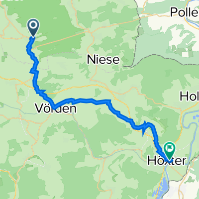
Overview
About this route
- -:--
- Duration
- 54.9 km
- Distance
- 744 m
- Ascent
- 700 m
- Descent
- ---
- Avg. speed
- 486 m
- Avg. speed
Route quality
Waytypes & surfaces along the route
Waytypes
Road
16.9 km
(31 %)
Busy road
16.8 km
(31 %)
Surfaces
Paved
27.5 km
(50 %)
Unpaved
9.3 km
(17 %)
Asphalt
24.6 km
(45 %)
Gravel
7.7 km
(14 %)
Continue with Bikemap
Use, edit, or download this cycling route
You would like to ride Weserbergland / Lippe 1.0.1 or customize it for your own trip? Here is what you can do with this Bikemap route:
Free features
- Save this route as favorite or in collections
- Copy & plan your own version of this route
- Sync your route with Garmin or Wahoo
Premium features
Free trial for 3 days, or one-time payment. More about Bikemap Premium.
- Navigate this route on iOS & Android
- Export a GPX / KML file of this route
- Create your custom printout (try it for free)
- Download this route for offline navigation
Discover more Premium features.
Get Bikemap PremiumFrom our community
Other popular routes starting in Schieder-Schwalenberg
 schwalenberg
- Distance
- 27.3 km
- Ascent
- 260 m
- Descent
- 283 m
- Location
- Schieder-Schwalenberg, North Rhine-Westphalia, Germany
 Schwalenberg-Corvey
- Distance
- 24.5 km
- Ascent
- 237 m
- Descent
- 382 m
- Location
- Schieder-Schwalenberg, North Rhine-Westphalia, Germany
 Bergstrecke Schwalenberg-Rischenau-Kollerbeck-Kariensiek
- Distance
- 26.7 km
- Ascent
- 407 m
- Descent
- 407 m
- Location
- Schieder-Schwalenberg, North Rhine-Westphalia, Germany
 Mal anders um den Schiedersee
- Distance
- 17.4 km
- Ascent
- 477 m
- Descent
- 480 m
- Location
- Schieder-Schwalenberg, North Rhine-Westphalia, Germany
 Lügde nach Lügde
- Distance
- 4.4 km
- Ascent
- 212 m
- Descent
- 8 m
- Location
- Schieder-Schwalenberg, North Rhine-Westphalia, Germany
 2014 Vörden - Carolinensiel
- Distance
- 302.2 km
- Ascent
- 178 m
- Descent
- 422 m
- Location
- Schieder-Schwalenberg, North Rhine-Westphalia, Germany
 Rischenauer Trainingsroute
- Distance
- 38.4 km
- Ascent
- 333 m
- Descent
- 395 m
- Location
- Schieder-Schwalenberg, North Rhine-Westphalia, Germany
 Hohehaus - Höxter
- Distance
- 35.8 km
- Ascent
- 239 m
- Descent
- 252 m
- Location
- Schieder-Schwalenberg, North Rhine-Westphalia, Germany
Open it in the app