

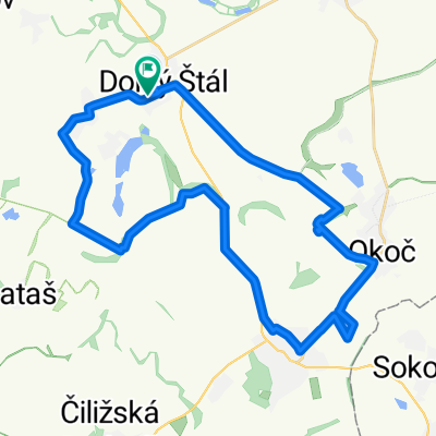
Töltésen Alsó Határ Gúta Nyárasd
A cycling route starting in Veľký Meder, Trnavský kraj, Slovak Republic.
Overview
About this route
Töltésen Alsó Határ Gúta Nyárasd
- -:--
- Duration
- 44.7 km
- Distance
- 23 m
- Ascent
- 23 m
- Descent
- ---
- Avg. speed
- ---
- Avg. speed

Route quality
Waytypes & surfaces along the route
Waytypes
Track
23.1 km
(52 %)
Quiet road
10.1 km
(23 %)
Surfaces
Paved
13.1 km
(29 %)
Unpaved
28.8 km
(64 %)
Gravel
28.8 km
(64 %)
Asphalt
12.7 km
(28 %)
Continue with Bikemap
Use, edit, or download this cycling route
You would like to ride Töltésen Alsó Határ Gúta Nyárasd or customize it for your own trip? Here is what you can do with this Bikemap route:
Free features
- Save this route as favorite or in collections
- Copy & plan your own version of this route
- Sync your route with Garmin or Wahoo
Premium features
Free trial for 3 days, or one-time payment. More about Bikemap Premium.
- Navigate this route on iOS & Android
- Export a GPX / KML file of this route
- Create your custom printout (try it for free)
- Download this route for offline navigation
Discover more Premium features.
Get Bikemap PremiumFrom our community
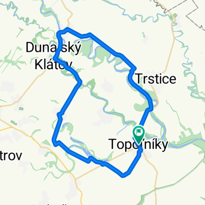
Other popular routes starting in Veľký Meder
 Kikeleti túra
- Distance
- 36.5 km
- Ascent
- 17 m
- Descent
- 14 m
- Location
- Veľký Meder, Trnavský kraj, Slovak Republic
 Szülinapi túra 2018 - Eperjes
- Distance
- 46.5 km
- Ascent
- 0 m
- Descent
- 0 m
- Location
- Veľký Meder, Trnavský kraj, Slovak Republic
 Nyárbúcsúztató 48
- Distance
- 48.6 km
- Ascent
- 9 m
- Descent
- 9 m
- Location
- Veľký Meder, Trnavský kraj, Slovak Republic
 Tallósi tóhoz 1.
- Distance
- 68.5 km
- Ascent
- 22 m
- Descent
- 21 m
- Location
- Veľký Meder, Trnavský kraj, Slovak Republic
 Út a Platánhoz
- Distance
- 54.2 km
- Ascent
- 13 m
- Descent
- 16 m
- Location
- Veľký Meder, Trnavský kraj, Slovak Republic
 MTB 50 - Danube Bikemaraton / ALI-BI
- Distance
- 47.9 km
- Ascent
- 16 m
- Descent
- 18 m
- Location
- Veľký Meder, Trnavský kraj, Slovak Republic
 MTB 50 - Danube Bikemaraton / ALI-BI
- Distance
- 50.9 km
- Ascent
- 37 m
- Descent
- 33 m
- Location
- Veľký Meder, Trnavský kraj, Slovak Republic
 Tanyatúra 2014. marc. 8.
- Distance
- 38.2 km
- Ascent
- 0 m
- Descent
- 0 m
- Location
- Veľký Meder, Trnavský kraj, Slovak Republic
Open it in the app