

Agapia Monastery
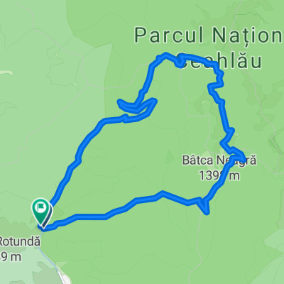
A cycling route starting in Telec, Neamț County, Romania.
Overview
About this route
Dupa directia traseului se pot vizita manastirile in ordinea urmatoare : Secu-Sihastria-Sihla-Agapia. Drumul forestier Sihastria este foarte bun si usor de orientat ! Dum de tara din Cracaoani spre Mitocul Balan extrem de bun calitativ cum nu este altul ! In schimb DF 155K spre Hangu este impracticabil (drum pt TAF) si este foarte dificil orientativ. Recomand ca 155K sa fie foarte bine stabilit de acasa si odata ajuns acolo pe langa echipamentul bicicletei sa existe un GPS sau telefon care are aplicatia respectiva (risc lipsa semnal) sau cel mai sigur o harta a judetului cu toate drumurile posibile.
Traseul a fost parcurs in doua zile: 1. 95km pauza Agapia 2. 103km.- -:--
- Duration
- 198.3 km
- Distance
- 2,711 m
- Ascent
- 2,704 m
- Descent
- ---
- Avg. speed
- ---
- Max. altitude

Route quality
Waytypes & surfaces along the route
Waytypes
Track
65.4 km
(33 %)
Road
23.8 km
(12 %)
Surfaces
Paved
113 km
(57 %)
Unpaved
83.3 km
(42 %)
Asphalt
113 km
(57 %)
Ground
51.6 km
(26 %)
Continue with Bikemap
Use, edit, or download this cycling route
You would like to ride Agapia Monastery or customize it for your own trip? Here is what you can do with this Bikemap route:
Free features
- Save this route as favorite or in collections
- Copy & plan your own version of this route
- Split it into stages to create a multi-day tour
- Sync your route with Garmin or Wahoo
Premium features
Free trial for 3 days, or one-time payment. More about Bikemap Premium.
- Navigate this route on iOS & Android
- Export a GPX / KML file of this route
- Create your custom printout (try it for free)
- Download this route for offline navigation
Discover more Premium features.
Get Bikemap PremiumFrom our community
Other popular routes starting in Telec
 Bicazul ardelean- Dochia
- Distance
- 12.9 km
- Ascent
- 1,214 m
- Descent
- 107 m
- Location
- Telec, Neamț County, Romania
 Ps Creangă-Chiozrez-Țengheler-Pângărați
- Distance
- 114 km
- Ascent
- 2,003 m
- Descent
- 1,984 m
- Location
- Telec, Neamț County, Romania
 pasul pangarati, cheile bicazului 19 iulie
- Distance
- 11.5 km
- Ascent
- 241 m
- Descent
- 921 m
- Location
- Telec, Neamț County, Romania
 ps Ilia- Trei Fantani-Lacul Rosu
- Distance
- 77.5 km
- Ascent
- 1,109 m
- Descent
- 1,126 m
- Location
- Telec, Neamț County, Romania
 Poiana Stanile- poiana Varatec- Neagra
- Distance
- 34.4 km
- Ascent
- 918 m
- Descent
- 919 m
- Location
- Telec, Neamț County, Romania
 Hagota-Jolotca-Toplita-Borsec-Tulghes
- Distance
- 116.7 km
- Ascent
- 1,394 m
- Descent
- 1,394 m
- Location
- Telec, Neamț County, Romania
 Lacul Rosu-Ditrau
- Distance
- 101.5 km
- Ascent
- 1,765 m
- Descent
- 1,765 m
- Location
- Telec, Neamț County, Romania
 Bistra.19km.700dif
- Distance
- 19 km
- Ascent
- 701 m
- Descent
- 693 m
- Location
- Telec, Neamț County, Romania
Open it in the app