

Bad Klosterlausnitz-Zeitzgrund-Tälerdörfer
A cycling route starting in Gera, Free State of Thuringia, Germany.
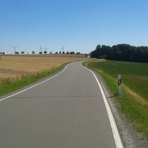
Overview
About this route
83 km
- -:--
- Duration
- 83.1 km
- Distance
- 590 m
- Ascent
- 591 m
- Descent
- ---
- Avg. speed
- ---
- Avg. speed

Route quality
Waytypes & surfaces along the route
Waytypes
Busy road
59 km
(71 %)
Road
7.4 km
(9 %)
Surfaces
Paved
68.7 km
(83 %)
Unpaved
6.5 km
(8 %)
Asphalt
65.1 km
(78 %)
Ground
4.6 km
(6 %)
Continue with Bikemap
Use, edit, or download this cycling route
You would like to ride Bad Klosterlausnitz-Zeitzgrund-Tälerdörfer or customize it for your own trip? Here is what you can do with this Bikemap route:
Free features
- Save this route as favorite or in collections
- Copy & plan your own version of this route
- Sync your route with Garmin or Wahoo
Premium features
Free trial for 3 days, or one-time payment. More about Bikemap Premium.
- Navigate this route on iOS & Android
- Export a GPX / KML file of this route
- Create your custom printout (try it for free)
- Download this route for offline navigation
Discover more Premium features.
Get Bikemap PremiumFrom our community
Other popular routes starting in Gera
 Gera Süd Runde MTB
- Distance
- 64 km
- Ascent
- 855 m
- Descent
- 860 m
- Location
- Gera, Free State of Thuringia, Germany
 Gersche Sommertour (rund um Gera)
- Distance
- 40.5 km
- Ascent
- 276 m
- Descent
- 278 m
- Location
- Gera, Free State of Thuringia, Germany
 Mühltal bei Eisenberg
- Distance
- 51 km
- Ascent
- 278 m
- Descent
- 278 m
- Location
- Gera, Free State of Thuringia, Germany
 Mühltal
- Distance
- 44.9 km
- Ascent
- 298 m
- Descent
- 299 m
- Location
- Gera, Free State of Thuringia, Germany
 Relaxed Freitag Route In Gera
- Distance
- 16.1 km
- Ascent
- 204 m
- Descent
- 201 m
- Location
- Gera, Free State of Thuringia, Germany
 Mühltalrunde etwas größer
- Distance
- 50.8 km
- Ascent
- 318 m
- Descent
- 318 m
- Location
- Gera, Free State of Thuringia, Germany
 Crimmitschau - Kap Arkona 2013 R 01/T01/TA02/V01
- Distance
- 29 km
- Ascent
- 171 m
- Descent
- 205 m
- Location
- Gera, Free State of Thuringia, Germany
 Gera Pegau
- Distance
- 46.9 km
- Ascent
- 143 m
- Descent
- 201 m
- Location
- Gera, Free State of Thuringia, Germany
Open it in the app