Premium Badge Download on the App Store Get it on Google Play Turn-by-turn Navigation Offline Maps Bike Type Optimized Routing Premium Maps Custom Bike Computer Export Routes Route Previews Fall Detection Premium Support

Cycling Route in Overath, North Rhine-Westphalia, Germany

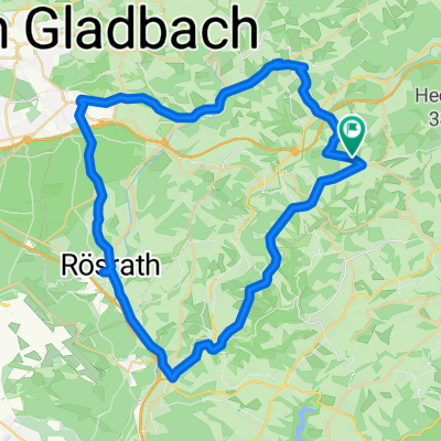
Bergische Runde 59 km

1
Open this route in the Bikemap app

Open this route in the Bikemap app

Open this route in Bikemap Web

Open this route in Bikemap Web

59 km
Distance
746 m
Ascent
749 m
Descent
-:-- h
Duration
-- km/h
Avg. Speed
--- m
Max. Elevation

About This Route

Start Immekeppel - Feuerwehrhaus - Parkplatz > Wiesenweg > über L 284 > alte Bahntrasse > am Osthang verschiedene Trails > über L 284 auf alter Bahnstrasse > Schloss Georghausen auf X 29  V 13 Oberkollenbach > V4 Niederkollenbach > Eichof > Raute 9 Offermannsberg > Forsten auf X 19 Fähnrrichstüttem auf X 28 > Mittel Unter Holl Remshage auf X 11a > Hözerkopf (Segelflugplatz) > Wüstenhof > Hohkeppel auf L 84 bis Hufe > rechts abfahren am Westhang (Trails) bis Untergündemich rechts durch Wald/Wiese (Trails) zum Ausgangspunkt Immekeppel Parkplatz - Glück Auf Schrumpel -

TEASI track 20141101_111529.gpx

This cycling route is ideal for: MTB

You will cycle on the following surfaces: Unpaved Gravel

Customize this cycling route with the Bikemap route planner.

Make it yours!

Did you know? You can use this route as a template in our cycling route planner if you don't wish to start from scratch. Customize it based on your needs to plan your perfect cycling tour.

Open it in the app