Premium Badge Download on the App Store Get it on Google Play Turn-by-turn Navigation Offline Maps Bike Type Optimized Routing Premium Maps Custom Bike Computer Export Routes Route Previews Fall Detection Premium Support

Cycling Route in Tazacorte, Canary Islands, Spain

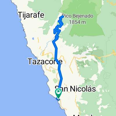
Puerto Naos - Fuencaliente - El Paso - Puerto Naos

2
Open this route in the Bikemap app

Open this route in the Bikemap app

Open this route in Bikemap Web

Open this route in Bikemap Web

59 km
Distance
1080 m
Ascent
1071 m
Descent
-:-- h
Duration
-- km/h
Avg. Speed
--- m
Max. Elevation

About This Route

Diese Route hat es in sich.

Man sollte früh aufbrechen, um die erste Rampe nicht in der Sonne fahren zu müssen.

Wenn man Todoque erreicht hat, wird die Steigung zwar moderater, aber es geht ständig bergauf bis San Nicolas. Ab hier fährt man auf der Panoramastraße weiter nach Süden. Es bieten sich phantastische Ausblicke auf die Südwestküste.

Fuencaliente liegt oberhalb des Vulkans San Antonio und hier kann man eine Verschnaufpause einlegen.

Zurück geht es bis San Nicolas auf der gleichen Strecke, wobei man überwiegend bergab rollt. Ein Abstecher über Tacande bietet sich an.

Von hier ab geht es nur noch bergab (800 hm) bis zum Ausgangspunkt.

Das Willkommensbier hat man sich redlich verdient !

This cycling route is ideal for: Road bike MTB

You will cycle on the following surfaces: Paved

Customize this cycling route with the Bikemap route planner.

Make it yours!

Did you know? You can use this route as a template in our cycling route planner if you don't wish to start from scratch. Customize it based on your needs to plan your perfect cycling tour.

Open it in the app