

Festungsring Köln
A cycling route starting in Poll, North Rhine-Westphalia, Germany.
Overview
About this route
auf den Spuren des preußischen Kölns:
Der Festungsring Köln war eine Festungsanlage, die von Preußen gebaut wurde und aus 2 Ringen (äußerem und innerem Festungsring bestand).- -:--
- Duration
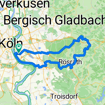
- 63.2 km
- Distance
- 120 m
- Ascent
- 122 m
- Descent
- ---
- Avg. speed
- ---
- Avg. speed

Route quality
Waytypes & surfaces along the route
Waytypes
Path
29.9 km
(47 %)
Quiet road
12.1 km
(19 %)
Surfaces
Paved
45.1 km
(71 %)
Unpaved
10.4 km
(16 %)
Asphalt
39.1 km
(62 %)
Gravel
8.4 km
(13 %)
Route highlights
Points of interest along the route

Photo after 1.1 km
Fort VIII (ehem.)

Photo after 3.4 km
Zwischenwerk VIII a

Photo after 4.3 km
Fort IV

Photo after 6.5 km
Fort VII

Photo after 8.6 km
Zwischenwerk VI b (ehem.) umgebaut zum Geißbockheim des 1. FC Köln.

Photo after 10.5 km
Fort VI

Point of interest after 10.9 km
Restaurant Haus am See Bachemer Landstr. 420 50935 Köln Wir sind jeden Tag für Sie da: ab 10:00 Uhr - 23:00 Uhr

Photo after 11.9 km
Zwischenwerk VI a (ehem.)

Photo after 14.7 km
Haus Belvedere: Der im Stil eines klassizistischen Landhauses erbaute Bahnhof "Belvedere" in Köln-Müngersdorf ist als ältestes erhaltenes Bahnhofsgebäude Deutschlands

Photo after 17 km
Zwischenwerk IV b Vogelsang

Photo after 18.6 km
Fort IV Bocklemund

Point of interest after 19.3 km
Restaurant Adria e.K. Grevenbroicher Str. 59 50829 Köln Tel:+49 221 508205 Öffnung: 11:00 bis 15:00 Uhr

Photo after 21.9 km
Fort III - Nüssenberg/Ossendorf

Photo after 24.7 km
Fort II "Longerich"

Photo after 43.3 km
Fort XII (ehem.)

Photo after 47.3 km
Zwischenwerk XI b

Photo after 48.4 km
Fort XI

Photo after 51.6 km
Zwischenwerk X c

Photo after 53.8 km
Fort X

Photo after 55.9 km
Zwischenwerk X a

Photo after 59 km
Fort IX

Photo after 60.7 km
Zwischenwerk IX a
Continue with Bikemap
Use, edit, or download this cycling route
You would like to ride Festungsring Köln or customize it for your own trip? Here is what you can do with this Bikemap route:
Free features
- Save this route as favorite or in collections
- Copy & plan your own version of this route
- Sync your route with Garmin or Wahoo
Premium features
Free trial for 3 days, or one-time payment. More about Bikemap Premium.
- Navigate this route on iOS & Android
- Export a GPX / KML file of this route
- Create your custom printout (try it for free)
- Download this route for offline navigation
Discover more Premium features.
Get Bikemap PremiumFrom our community
Other popular routes starting in Poll
 Rund um Köln
- Distance
- 43.1 km
- Ascent
- 104 m
- Descent
- 108 m
- Location
- Poll, North Rhine-Westphalia, Germany
 Weidenweg, Cologne to Quintinsstraße, Mainz
- Distance
- 193.2 km
- Ascent
- 1,380 m
- Descent
- 1,328 m
- Location
- Poll, North Rhine-Westphalia, Germany
 Englischer Garten Bonn
- Distance
- 65.4 km
- Ascent
- 99 m
- Descent
- 101 m
- Location
- Poll, North Rhine-Westphalia, Germany
 Poll-Hohkeppel-Altenrath-Poll
- Distance
- 74.5 km
- Ascent
- 289 m
- Descent
- 291 m
- Location
- Poll, North Rhine-Westphalia, Germany
 65 Gravel Köfo Immek.Heiligenhs.Hoffngthal
- Distance
- 63.6 km
- Ascent
- 1,032 m
- Descent
- 1,031 m
- Location
- Poll, North Rhine-Westphalia, Germany
 RTF Rodenkirchen
- Distance
- 146.3 km
- Ascent
- 1,168 m
- Descent
- 1,136 m
- Location
- Poll, North Rhine-Westphalia, Germany
 Oberländer Ufer 1, Köln nach Vogtstraße 22, Rheinbrohl
- Distance
- 271.8 km
- Ascent
- 1,613 m
- Descent
- 1,598 m
- Location
- Poll, North Rhine-Westphalia, Germany
 Bergische Trainingsrunde II
- Distance
- 83 km
- Ascent
- 840 m
- Descent
- 833 m
- Location
- Poll, North Rhine-Westphalia, Germany
Open it in the app