

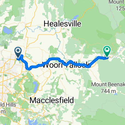
Lilydale to Upper Ferntree Gully
A cycling route starting in Lilydale, Victoria, Australia.
Overview
About this route
North to south across Dandenongs via Kalorama, Olinda and Sassafrass.
- -:--
- Duration
- 33 km
- Distance
- 791 m
- Ascent
- 756 m
- Descent
- ---
- Avg. speed
- ---
- Avg. speed
Route quality
Waytypes & surfaces along the route
Waytypes
Busy road
10.7 km
(32 %)
Quiet road
8.7 km
(26 %)
Surfaces
Paved
17.8 km
(54 %)
Unpaved
11.9 km
(36 %)
Asphalt
16.9 km
(51 %)
Unpaved (undefined)
5.9 km
(18 %)
Continue with Bikemap
Use, edit, or download this cycling route
You would like to ride Lilydale to Upper Ferntree Gully or customize it for your own trip? Here is what you can do with this Bikemap route:
Free features
- Save this route as favorite or in collections
- Copy & plan your own version of this route
- Sync your route with Garmin or Wahoo
Premium features
Free trial for 3 days, or one-time payment. More about Bikemap Premium.
- Navigate this route on iOS & Android
- Export a GPX / KML file of this route
- Create your custom printout (try it for free)
- Download this route for offline navigation
Discover more Premium features.
Get Bikemap PremiumFrom our community
Other popular routes starting in Lilydale
 Lilydale to Yarra Junction
- Distance
- 31.7 km
- Ascent
- 337 m
- Descent
- 313 m
- Location
- Lilydale, Victoria, Australia
 Lilydale Warburton Rail Trail
- Distance
- 79.2 km
- Ascent
- 443 m
- Descent
- 410 m
- Location
- Lilydale, Victoria, Australia
 13. Lilydale ti Melbourne
- Distance
- 45.4 km
- Ascent
- 325 m
- Descent
- 403 m
- Location
- Lilydale, Victoria, Australia
 lillydale lake poke
- Distance
- 18.7 km
- Ascent
- 251 m
- Descent
- 241 m
- Location
- Lilydale, Victoria, Australia
 Lilydale to Yering and return
- Distance
- 19.3 km
- Ascent
- 85 m
- Descent
- 84 m
- Location
- Lilydale, Victoria, Australia
 15-01-01 Lilydale-Mt Evelyn via Rail Trail
- Distance
- 14.8 km
- Ascent
- 170 m
- Descent
- 172 m
- Location
- Lilydale, Victoria, Australia
 Lilydale to Warburton Rail Trail - Gravel
- Distance
- 40.3 km
- Ascent
- 266 m
- Descent
- 196 m
- Location
- Lilydale, Victoria, Australia
 Climbing from Lilydale, Acheron Way, the Don
- Distance
- 149.7 km
- Ascent
- 3,262 m
- Descent
- 2,977 m
- Location
- Lilydale, Victoria, Australia
Open it in the app