

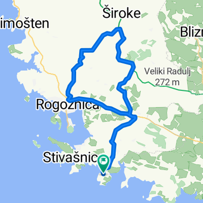
Rogoznica-Jelinjak-Primošten
A cycling route starting in Rogoznica, Šibensko-Kninska Županija, Croatia.
Overview
About this route
MTB Rogoznica Jelinjak Primošten
- -:--
- Duration
- 48.5 km
- Distance
- 660 m
- Ascent
- 660 m
- Descent
- ---
- Avg. speed
- ---
- Avg. speed
Route quality
Waytypes & surfaces along the route
Waytypes
Quiet road
15.6 km
(32 %)
Track
15.3 km
(31 %)
Surfaces
Paved
25.3 km
(52 %)
Unpaved
14.4 km
(30 %)
Asphalt
24.9 km
(51 %)
Gravel
14.4 km
(30 %)
Continue with Bikemap
Use, edit, or download this cycling route
You would like to ride Rogoznica-Jelinjak-Primošten or customize it for your own trip? Here is what you can do with this Bikemap route:
Free features
- Save this route as favorite or in collections
- Copy & plan your own version of this route
- Sync your route with Garmin or Wahoo
Premium features
Free trial for 3 days, or one-time payment. More about Bikemap Premium.
- Navigate this route on iOS & Android
- Export a GPX / KML file of this route
- Create your custom printout (try it for free)
- Download this route for offline navigation
Discover more Premium features.
Get Bikemap PremiumFrom our community
Other popular routes starting in Rogoznica
 Erkundungsrunde westlich
- Distance
- 17.3 km
- Ascent
- 376 m
- Descent
- 381 m
- Location
- Rogoznica, Šibensko-Kninska Županija, Croatia
 Razanj
- Distance
- 36.4 km
- Ascent
- 807 m
- Descent
- 805 m
- Location
- Rogoznica, Šibensko-Kninska Županija, Croatia
 Recovered Route
- Distance
- 12 km
- Ascent
- 153 m
- Descent
- 162 m
- Location
- Rogoznica, Šibensko-Kninska Županija, Croatia
 Kanica
- Distance
- 32.1 km
- Ascent
- 582 m
- Descent
- 582 m
- Location
- Rogoznica, Šibensko-Kninska Županija, Croatia
 Ražanj 117 to Ražanj 117
- Distance
- 29.2 km
- Ascent
- 523 m
- Descent
- 523 m
- Location
- Rogoznica, Šibensko-Kninska Županija, Croatia
 Salići Kosa 4, Dvornica to Salići Kosa 4, Dvornica
- Distance
- 12.4 km
- Ascent
- 388 m
- Descent
- 393 m
- Location
- Rogoznica, Šibensko-Kninska Županija, Croatia
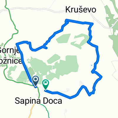 Sapina Doca to Sapina Doca
- Distance
- 9.5 km
- Ascent
- 231 m
- Descent
- 213 m
- Location
- Rogoznica, Šibensko-Kninska Županija, Croatia
 Kotelja-Pozorac
- Distance
- 9.3 km
- Ascent
- 50 m
- Descent
- 282 m
- Location
- Rogoznica, Šibensko-Kninska Županija, Croatia
Open it in the app