

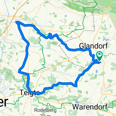
mtb=borgholzhausen-dissen-bad rothenfelde-remsede-füchtorf
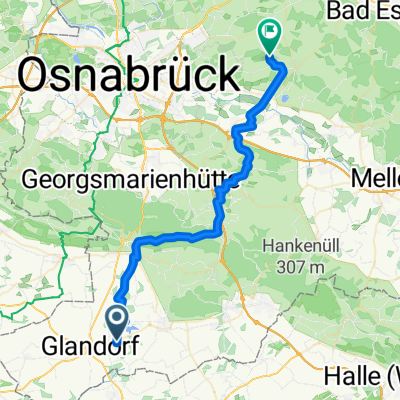
A cycling route starting in Glandorf, Lower Saxony, Germany.
Overview
About this route
mtb circuit, partly agricultural paths and forest and field paths
- -:--
- Duration
- 64.1 km
- Distance
- 375 m
- Ascent
- 375 m
- Descent
- ---
- Avg. speed
- ---
- Max. altitude

Route quality
Waytypes & surfaces along the route
Waytypes
Quiet road
39.1 km
(61 %)
Track
11.5 km
(18 %)
Surfaces
Paved
39.1 km
(61 %)
Unpaved
12.2 km
(19 %)
Asphalt
37.2 km
(58 %)
Gravel
7.7 km
(12 %)
Continue with Bikemap
Use, edit, or download this cycling route
You would like to ride mtb=borgholzhausen-dissen-bad rothenfelde-remsede-füchtorf or customize it for your own trip? Here is what you can do with this Bikemap route:
Free features
- Save this route as favorite or in collections
- Copy & plan your own version of this route
- Sync your route with Garmin or Wahoo
Premium features
Free trial for 3 days, or one-time payment. More about Bikemap Premium.
- Navigate this route on iOS & Android
- Export a GPX / KML file of this route
- Create your custom printout (try it for free)
- Download this route for offline navigation
Discover more Premium features.
Get Bikemap PremiumFrom our community
Other popular routes starting in Glandorf
 Ossenbrock , am Renkenöhrer See vorbei
- Distance
- 36.5 km
- Ascent
- 419 m
- Descent
- 391 m
- Location
- Glandorf, Lower Saxony, Germany
 rennrad=telgte-ladbergen-kattenvenne-füchtorf
- Distance
- 69.6 km
- Ascent
- 41 m
- Descent
- 42 m
- Location
- Glandorf, Lower Saxony, Germany
 rennrad=iburg-lengerich-richtung erpenbecker str.-richtung tecklenburg-hlperdorf-füchtorf
- Distance
- 83.5 km
- Ascent
- 335 m
- Descent
- 333 m
- Location
- Glandorf, Lower Saxony, Germany
 mtb=borgholzhausen-dissen-bad rothenfelde-remsede-füchtorf
- Distance
- 64.1 km
- Ascent
- 375 m
- Descent
- 375 m
- Location
- Glandorf, Lower Saxony, Germany
 Haus-Arbeit
- Distance
- 6.5 km
- Ascent
- 22 m
- Descent
- 11 m
- Location
- Glandorf, Lower Saxony, Germany
 mtb=warendorf-an der ems nach telgte-füchtorf
- Distance
- 55.4 km
- Ascent
- 111 m
- Descent
- 111 m
- Location
- Glandorf, Lower Saxony, Germany
 Permanente RTF Füchtorfer-Teuto-Tour
- Distance
- 78.2 km
- Ascent
- 416 m
- Descent
- 417 m
- Location
- Glandorf, Lower Saxony, Germany
 Parkring 1, Glandorf nach Kolpingstraße 6, Glandorf
- Distance
- 46.1 km
- Ascent
- 230 m
- Descent
- 230 m
- Location
- Glandorf, Lower Saxony, Germany
Open it in the app