

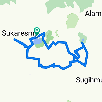
Patuha Cagar Alam Gn Tilu
A cycling route starting in Banjar, West Java, Indonesia.
Overview
About this route
Start and finish Cikembang
- -:--
- Duration
- 29.9 km
- Distance
- 1,048 m
- Ascent
- 1,048 m
- Descent
- ---
- Avg. speed
- ---
- Avg. speed

Continue with Bikemap
Use, edit, or download this cycling route
You would like to ride Patuha Cagar Alam Gn Tilu or customize it for your own trip? Here is what you can do with this Bikemap route:
Free features
- Save this route as favorite or in collections
- Copy & plan your own version of this route
- Sync your route with Garmin or Wahoo
Premium features
Free trial for 3 days, or one-time payment. More about Bikemap Premium.
- Navigate this route on iOS & Android
- Export a GPX / KML file of this route
- Create your custom printout (try it for free)
- Download this route for offline navigation
Discover more Premium features.
Get Bikemap PremiumFrom our community
Other popular routes starting in Banjar
 KOLOZAL#8 Route RancaUpas SituPatengan Kawah Rengganis
- Distance
- 23.3 km
- Ascent
- 496 m
- Descent
- 496 m
- Location
- Banjar, West Java, Indonesia
 Patuha Cagar Alam Gn Tilu
- Distance
- 29.9 km
- Ascent
- 1,048 m
- Descent
- 1,048 m
- Location
- Banjar, West Java, Indonesia
 Banjar Cycling
- Distance
- 68.3 km
- Ascent
- 1,983 m
- Descent
- 2,688 m
- Location
- Banjar, West Java, Indonesia
 Cikembang-Situ Patengan
- Distance
- 51.5 km
- Ascent
- 1,421 m
- Descent
- 1,415 m
- Location
- Banjar, West Java, Indonesia
 Sunan ibu via patuha
- Distance
- 48.6 km
- Ascent
- 780 m
- Descent
- 2,019 m
- Location
- Banjar, West Java, Indonesia
 Patengan-Kawah Putih lewat belakang-Patengan
- Distance
- 37.8 km
- Ascent
- 1,132 m
- Descent
- 1,128 m
- Location
- Banjar, West Java, Indonesia
 route downhill gambung pangkalan
- Distance
- 8.6 km
- Ascent
- 824 m
- Descent
- 1,379 m
- Location
- Banjar, West Java, Indonesia
 Tanjakkan Kawah Putih
- Distance
- 5.3 km
- Ascent
- 548 m
- Descent
- 98 m
- Location
- Banjar, West Java, Indonesia
Open it in the app