

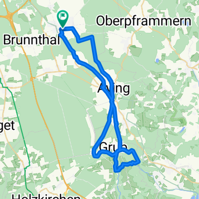
Neuer Arbeitsweg
A cycling route starting in Höhenkirchen-Siegertsbrunn, Bavaria, Germany.
Overview
About this route
- -:--
- Duration
- 6.2 km
- Distance
- 24 m
- Ascent
- 22 m
- Descent
- ---
- Avg. speed
- 605 m
- Avg. speed
Route quality
Waytypes & surfaces along the route
Waytypes
Track
2.6 km
(42 %)
Path
2 km
(33 %)
Surfaces
Paved
3.3 km
(54 %)
Unpaved
2.8 km
(46 %)
Asphalt
3 km
(49 %)
Gravel
1.7 km
(27 %)
Continue with Bikemap
Use, edit, or download this cycling route
You would like to ride Neuer Arbeitsweg or customize it for your own trip? Here is what you can do with this Bikemap route:
Free features
- Save this route as favorite or in collections
- Copy & plan your own version of this route
- Sync your route with Garmin or Wahoo
Premium features
Free trial for 3 days, or one-time payment. More about Bikemap Premium.
- Navigate this route on iOS & Android
- Export a GPX / KML file of this route
- Create your custom printout (try it for free)
- Download this route for offline navigation
Discover more Premium features.
Get Bikemap PremiumFrom our community
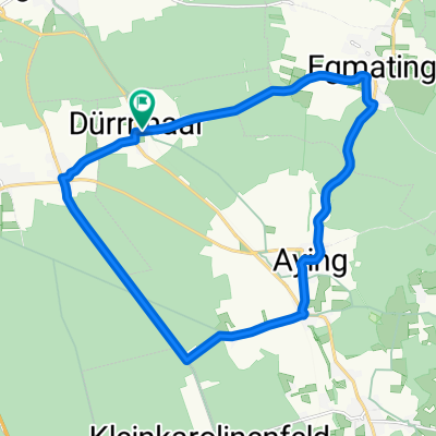
Other popular routes starting in Höhenkirchen-Siegertsbrunn
 Weg zur Arbeit
- Distance
- 20.4 km
- Ascent
- 16 m
- Descent
- 90 m
- Location
- Höhenkirchen-Siegertsbrunn, Bavaria, Germany
 Höhenkirchen-Valley
- Distance
- 66 km
- Ascent
- 841 m
- Descent
- 842 m
- Location
- Höhenkirchen-Siegertsbrunn, Bavaria, Germany
 31.1 Südroute
- Distance
- 31.7 km
- Ascent
- 108 m
- Descent
- 104 m
- Location
- Höhenkirchen-Siegertsbrunn, Bavaria, Germany
 SBR Deisenhofen Sauerlach_41km
- Distance
- 41.4 km
- Ascent
- 103 m
- Descent
- 101 m
- Location
- Höhenkirchen-Siegertsbrunn, Bavaria, Germany
 Höhenkirchen / Kleinhöhenkirchen mit Trails
- Distance
- 37.8 km
- Ascent
- 228 m
- Descent
- 228 m
- Location
- Höhenkirchen-Siegertsbrunn, Bavaria, Germany
 Kleine Runde
- Distance
- 18.4 km
- Ascent
- 131 m
- Descent
- 129 m
- Location
- Höhenkirchen-Siegertsbrunn, Bavaria, Germany
 Höhenkirchen-Kastensee-Aschbach-Höhenkirchen
- Distance
- 41.2 km
- Ascent
- 471 m
- Descent
- 460 m
- Location
- Höhenkirchen-Siegertsbrunn, Bavaria, Germany
 Rundfahrt Siegertsbrunn-Kirchstockach-Unterhaching-Neubiberg-Ottobrunn-Hohenbrunn-Siegertsbrunn
- Distance
- 26.3 km
- Ascent
- 22 m
- Descent
- 41 m
- Location
- Höhenkirchen-Siegertsbrunn, Bavaria, Germany
Open it in the app