

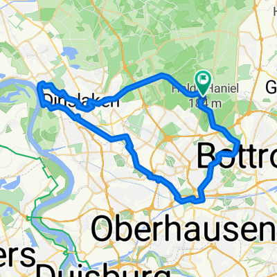
Wasserroute
A cycling route starting in Bottrop, North Rhine-Westphalia, Germany.
Overview
About this route
Bottrop, Oberhausen, Mülheim essen, Mülheim, Duisburg, Oberhausen Bottrop
(cloned from route 2586564)
- -:--
- Duration
- 66.4 km
- Distance
- 248 m
- Ascent
- 247 m
- Descent
- ---
- Avg. speed
- ---
- Avg. speed
Route quality
Waytypes & surfaces along the route
Waytypes
Path
27.3 km
(41 %)
Track
9.7 km
(15 %)
Surfaces
Paved
41.1 km
(62 %)
Unpaved
17.4 km
(26 %)
Asphalt
33.9 km
(51 %)
Gravel
13.9 km
(21 %)
Continue with Bikemap
Use, edit, or download this cycling route
You would like to ride Wasserroute or customize it for your own trip? Here is what you can do with this Bikemap route:
Free features
- Save this route as favorite or in collections
- Copy & plan your own version of this route
- Sync your route with Garmin or Wahoo
Premium features
Free trial for 3 days, or one-time payment. More about Bikemap Premium.
- Navigate this route on iOS & Android
- Export a GPX / KML file of this route
- Create your custom printout (try it for free)
- Download this route for offline navigation
Discover more Premium features.
Get Bikemap PremiumFrom our community
Other popular routes starting in Bottrop
 Osterfeld - Wesel (Grav-Insel) und zurück
- Distance
- 87.9 km
- Ascent
- 129 m
- Descent
- 141 m
- Location
- Bottrop, North Rhine-Westphalia, Germany
 11 Grafenmühle Schermbeck Krudenburg Grafenmühle
- Distance
- 48.4 km
- Ascent
- 129 m
- Descent
- 141 m
- Location
- Bottrop, North Rhine-Westphalia, Germany
 10 Grafenmühle - Bottr. Stadtpark
- Distance
- 14.5 km
- Ascent
- 84 m
- Descent
- 83 m
- Location
- Bottrop, North Rhine-Westphalia, Germany
 09.2 Grafenmühle - Hünxe
- Distance
- 38.8 km
- Ascent
- 130 m
- Descent
- 130 m
- Location
- Bottrop, North Rhine-Westphalia, Germany
 38 Oberhausen Halde Hohenwarth Westerholt
- Distance
- 70.8 km
- Ascent
- 276 m
- Descent
- 282 m
- Location
- Bottrop, North Rhine-Westphalia, Germany
 Bottrop-Oberhausen-Duisburg-Bottrop
- Distance
- 55.7 km
- Ascent
- 112 m
- Descent
- 112 m
- Location
- Bottrop, North Rhine-Westphalia, Germany
 große Rotbach Rundtour
- Distance
- 50.3 km
- Ascent
- 140 m
- Descent
- 140 m
- Location
- Bottrop, North Rhine-Westphalia, Germany
 RVR - Kirchheller Heide
- Distance
- 26.4 km
- Ascent
- 77 m
- Descent
- 87 m
- Location
- Bottrop, North Rhine-Westphalia, Germany
Open it in the app