

heihausen/neuerburg/eifel
A cycling route starting in Manderscheid, Rhineland-Palatinate, Germany.
Overview
About this route
45 km 1090 hm
- -:--
- Duration
- 45.4 km
- Distance
- 632 m
- Ascent
- 637 m
- Descent
- ---
- Avg. speed
- ---
- Max. altitude
Route quality
Waytypes & surfaces along the route
Waytypes
Road
13.6 km
(30 %)
Track
6.8 km
(15 %)
Surfaces
Paved
21.3 km
(47 %)
Unpaved
1.4 km
(3 %)
Asphalt
20.4 km
(45 %)
Paved (undefined)
0.9 km
(2 %)
Continue with Bikemap
Use, edit, or download this cycling route
You would like to ride heihausen/neuerburg/eifel or customize it for your own trip? Here is what you can do with this Bikemap route:
Free features
- Save this route as favorite or in collections
- Copy & plan your own version of this route
- Sync your route with Garmin or Wahoo
Premium features
Free trial for 3 days, or one-time payment. More about Bikemap Premium.
- Navigate this route on iOS & Android
- Export a GPX / KML file of this route
- Create your custom printout (try it for free)
- Download this route for offline navigation
Discover more Premium features.
Get Bikemap PremiumFrom our community
Other popular routes starting in Manderscheid
 heilhausen/oberweiler/schönecken/prüm/pronsfeld/heilhausen
- Distance
- 66.7 km
- Ascent
- 606 m
- Descent
- 564 m
- Location
- Manderscheid, Rhineland-Palatinate, Germany
 heihausen/neuerburg/eifel
- Distance
- 45.4 km
- Ascent
- 632 m
- Descent
- 637 m
- Location
- Manderscheid, Rhineland-Palatinate, Germany
 Be/Lux/Duit: Mandersheid-Bastogne Dag 4 - Be/Lux/Duit: Mandersheid-Bastogne Dag 4
- Distance
- 77 km
- Ascent
- 876 m
- Descent
- 730 m
- Location
- Manderscheid, Rhineland-Palatinate, Germany
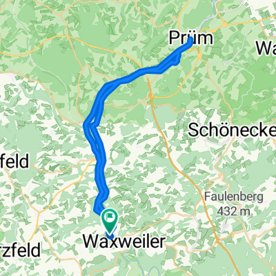
 heilhausen/prüm/schönecken/waxweiler
- Distance
- 40.4 km
- Ascent
- 480 m
- Descent
- 480 m
- Location
- Manderscheid, Rhineland-Palatinate, Germany
 Be/Lux/Duit: Mandersheid-Bastogne Dag 4
- Distance
- 77.1 km
- Ascent
- 1,004 m
- Descent
- 855 m
- Location
- Manderscheid, Rhineland-Palatinate, Germany
 prümradweg/oberweis/birkendell/waxweiler
- Distance
- 57.6 km
- Ascent
- 723 m
- Descent
- 729 m
- Location
- Manderscheid, Rhineland-Palatinate, Germany
 Ginshausermühle nach Ginshausermühle
- Distance
- 35.8 km
- Ascent
- 244 m
- Descent
- 276 m
- Location
- Manderscheid, Rhineland-Palatinate, Germany
 Lünebacher Straße 17, Waxweiler nach Lünebacher Straße 17, Waxweiler
- Distance
- 107.5 km
- Ascent
- 919 m
- Descent
- 923 m
- Location
- Manderscheid, Rhineland-Palatinate, Germany
Open it in the app