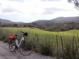
Mallorca: Manacor-Sant LLorenç-Son Carrió-Sant Llorenç-volta a Calicant-Manacor
A cycling route starting in Manacor, Balearic Islands, Spain.
Overview
About this route
Ruta fàcil que combina part de la malaurada via verda amb la volta per Infern (volta al massís de Calicant). Preciosa.
- -:--
- Duration
- 42.8 km
- Distance
- 365 m
- Ascent
- 365 m
- Descent
- ---
- Avg. speed
- ---
- Avg. speed
Route quality
Waytypes & surfaces along the route
Waytypes
Quiet road
22.6 km
(53 %)
Path
10.3 km
(24 %)
Surfaces
Paved
20.2 km
(47 %)
Unpaved
6.9 km
(16 %)
Asphalt
19.7 km
(46 %)
Gravel
6.2 km
(14 %)
Route highlights
Points of interest along the route

Photo after 7.5 km

Photo after 8.2 km

Photo after 8.4 km

Photo after 9.5 km

Photo after 9.8 km

Photo after 13.4 km

Photo after 24.2 km

Photo after 25 km

Photo after 26.4 km

Photo after 30.9 km

Photo after 37.1 km
Continue with Bikemap
Use, edit, or download this cycling route
You would like to ride Mallorca: Manacor-Sant LLorenç-Son Carrió-Sant Llorenç-volta a Calicant-Manacor or customize it for your own trip? Here is what you can do with this Bikemap route:
Free features
- Save this route as favorite or in collections
- Copy & plan your own version of this route
- Sync your route with Garmin or Wahoo
Premium features
Free trial for 3 days, or one-time payment. More about Bikemap Premium.
- Navigate this route on iOS & Android
- Export a GPX / KML file of this route
- Create your custom printout (try it for free)
- Download this route for offline navigation
Discover more Premium features.
Get Bikemap PremiumFrom our community
Other popular routes starting in Manacor
 Via Verde Manacor to Artá
- Distance
- 29 km
- Ascent
- 187 m
- Descent
- 136 m
- Location
- Manacor, Balearic Islands, Spain
 Ruta 4 Del Manacor rural fins al litoral
- Distance
- 29.5 km
- Ascent
- 286 m
- Descent
- 289 m
- Location
- Manacor, Balearic Islands, Spain
 Manacor/San llorenç/Petra
- Distance
- 60.6 km
- Ascent
- 694 m
- Descent
- 696 m
- Location
- Manacor, Balearic Islands, Spain
 Ruta 1 Manacor per l'interior
- Distance
- 28.5 km
- Ascent
- 171 m
- Descent
- 182 m
- Location
- Manacor, Balearic Islands, Spain
 Ruta 3 Manacor per na Borges i Calicant mod
- Distance
- 46.5 km
- Ascent
- 508 m
- Descent
- 507 m
- Location
- Manacor, Balearic Islands, Spain
 Manacor/son Prohens/son Valls
- Distance
- 51.8 km
- Ascent
- 370 m
- Descent
- 379 m
- Location
- Manacor, Balearic Islands, Spain
 Manacor/Son macia/Calas de Mallorca
- Distance
- 47.5 km
- Ascent
- 574 m
- Descent
- 574 m
- Location
- Manacor, Balearic Islands, Spain
 Manacor-Estany d´En Mas-Cala Mendia-Cala Anguila-Porto Cristo-Son Carrió-Sant Llorenç des Cardassar-Manacor
- Distance
- 55.5 km
- Ascent
- 362 m
- Descent
- 363 m
- Location
- Manacor, Balearic Islands, Spain
Open it in the app


