

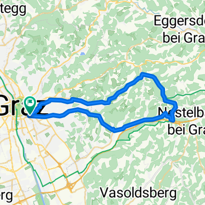
Graz: Innenstadt-Platte-Andritz und zurück
A cycling route starting in Graz, Styria, Austria.
Overview
About this route
Gefahren wurde gegen den Uhrzeigersinn. Die Wenisbucher Strasse führt steil zur Platte hinauf.
- -:--
- Duration
- 18.3 km
- Distance
- 255 m
- Ascent
- 244 m
- Descent
- ---
- Avg. speed
- 568 m
- Avg. speed
Route quality
Waytypes & surfaces along the route
Waytypes
Cycleway
6.5 km
(36 %)
Quiet road
6.3 km
(35 %)
Surfaces
Paved
16.1 km
(88 %)
Unpaved
1.2 km
(7 %)
Asphalt
14.8 km
(81 %)
Paved (undefined)
1.3 km
(7 %)
Route highlights
Points of interest along the route
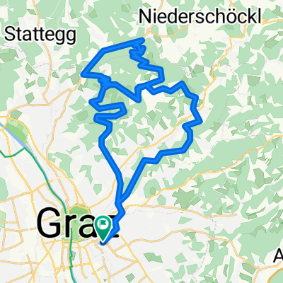
Point of interest after 3.8 km
ab hier dem Rad-/Fußgängerweg großteils entlang der Straßenbahntrasse folgen
Point of interest after 6.9 km
ab hier wird's steil: 10-20%
Point of interest after 7.8 km
hier wird's wieder flach
Point of interest after 8.4 km
Buschenschank "Wastl"
Point of interest after 9.4 km
von nun an geht's bergab
Point of interest after 15.6 km
Murradweg linkes Murufer Richtung Innenstadt
Continue with Bikemap
Use, edit, or download this cycling route
You would like to ride Graz: Innenstadt-Platte-Andritz und zurück or customize it for your own trip? Here is what you can do with this Bikemap route:
Free features
- Save this route as favorite or in collections
- Copy & plan your own version of this route
- Sync your route with Garmin or Wahoo
Premium features
Free trial for 3 days, or one-time payment. More about Bikemap Premium.
- Navigate this route on iOS & Android
- Export a GPX / KML file of this route
- Create your custom printout (try it for free)
- Download this route for offline navigation
Discover more Premium features.
Get Bikemap PremiumFrom our community
Other popular routes starting in Graz
 Coole Schöcklrunde
- Distance
- 44.7 km
- Ascent
- 1,096 m
- Descent
- 1,086 m
- Location
- Graz, Styria, Austria
 Graz - St. Pankrazen - Graz
- Distance
- 70.7 km
- Ascent
- 643 m
- Descent
- 643 m
- Location
- Graz, Styria, Austria
 Lassnitzhöhe short training route...
- Distance
- 28.5 km
- Ascent
- 330 m
- Descent
- 328 m
- Location
- Graz, Styria, Austria
 Platte und Hauenstein
- Distance
- 37.9 km
- Ascent
- 860 m
- Descent
- 860 m
- Location
- Graz, Styria, Austria
 Augarten-Schemerlhöhe-Fernitz-Augarten
- Distance
- 47.6 km
- Ascent
- 497 m
- Descent
- 499 m
- Location
- Graz, Styria, Austria
 um den schöckl
- Distance
- 95.5 km
- Ascent
- 1,352 m
- Descent
- 1,258 m
- Location
- Graz, Styria, Austria
 Plabutschrunde mit Ruine Gösting und Thalersee
- Distance
- 30.8 km
- Ascent
- 642 m
- Descent
- 642 m
- Location
- Graz, Styria, Austria
 stPETER UND DER WOLFsgraben CLONED FROM ROUTE 1034877
- Distance
- 28.6 km
- Ascent
- 547 m
- Descent
- 547 m
- Location
- Graz, Styria, Austria
Open it in the app