

MB-Tour durchs große Rodltal
A cycling route starting in Walding, Upper Austria, Austria.
Overview
About this route
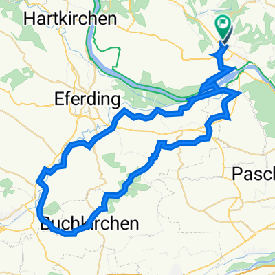
bei Rodlbrücke in Schwarzgrub beginnend, durchs große Rodltal nach Gramastetten und weiter zum Teil auf Wanderweg 190 Richtung Bahnhof Ottensheim, der Bahn entlang wieder Richtung Rodlbrücke
(cloned from route 45920)- -:--
- Duration
- 19 km
- Distance
- 478 m
- Ascent
- 481 m
- Descent
- ---
- Avg. speed
- ---
- Avg. speed
Route quality
Waytypes & surfaces along the route
Waytypes
Track
8.4 km
(44 %)
Quiet road
3.2 km
(17 %)
Surfaces
Paved
3.5 km
(18 %)
Unpaved
8.7 km
(46 %)
Unpaved (undefined)
6.5 km
(34 %)
Asphalt
2.7 km
(14 %)
Continue with Bikemap
Use, edit, or download this cycling route
You would like to ride MB-Tour durchs große Rodltal or customize it for your own trip? Here is what you can do with this Bikemap route:
Free features
- Save this route as favorite or in collections
- Copy & plan your own version of this route
- Sync your route with Garmin or Wahoo
Premium features
Free trial for 3 days, or one-time payment. More about Bikemap Premium.
- Navigate this route on iOS & Android
- Export a GPX / KML file of this route
- Create your custom printout (try it for free)
- Download this route for offline navigation
Discover more Premium features.
Get Bikemap PremiumFrom our community
Other popular routes starting in Walding
 Mayer Spargelrunde
- Distance
- 34.6 km
- Ascent
- 90 m
- Descent
- 89 m
- Location
- Walding, Upper Austria, Austria
 Badesee Mursberg Runde
- Distance
- 24.7 km
- Ascent
- 283 m
- Descent
- 303 m
- Location
- Walding, Upper Austria, Austria
 Landlweg
- Distance
- 44.7 km
- Ascent
- 233 m
- Descent
- 242 m
- Location
- Walding, Upper Austria, Austria
 St. Martin Angerer Runde
- Distance
- 31.3 km
- Ascent
- 502 m
- Descent
- 582 m
- Location
- Walding, Upper Austria, Austria
 Sportpark Neußerling Trops Walding
- Distance
- 55 km
- Ascent
- 749 m
- Descent
- 1,010 m
- Location
- Walding, Upper Austria, Austria
 Sportpark, Lacken, Bad Mühllacken, Sechterberg, Eferding, Walding.
- Distance
- 49.9 km
- Ascent
- 836 m
- Descent
- 851 m
- Location
- Walding, Upper Austria, Austria
 Walding nach Mayerhofberg Walding
- Distance
- 63.1 km
- Ascent
- 1,109 m
- Descent
- 1,115 m
- Location
- Walding, Upper Austria, Austria
 Sport-Park Pfingstrosen Rundfahrt Home
- Distance
- 62.9 km
- Ascent
- 988 m
- Descent
- 993 m
- Location
- Walding, Upper Austria, Austria
Open it in the app