

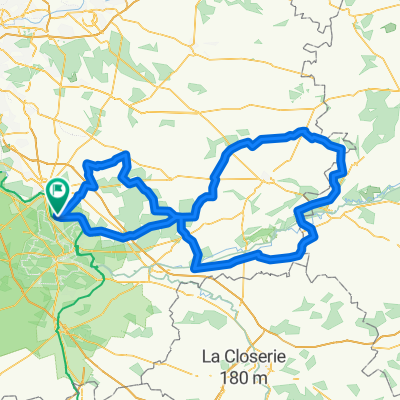
table du roi 50km
A cycling route starting in Chartrettes, Île-de-France Region, France.
Overview
About this route
joli circuit avec : route tournante longues vallées + cuvier, gorges de franchard, point de vue des hautes plaines, point de vue de hurlevent, joli sentier au sud du mont aigu (chemin michaud...) peu de zone sablonneuse, quelques bosses casse-pattes.
- -:--
- Duration
- 52.9 km
- Distance
- 334 m
- Ascent
- 334 m
- Descent
- ---
- Avg. speed
- ---
- Max. altitude
Route quality
Waytypes & surfaces along the route
Waytypes
Track
40.7 km
(77 %)
Path
10.6 km
(20 %)
Surfaces
Paved
1.6 km
(3 %)
Unpaved
10.6 km
(20 %)
Unpaved (undefined)
4.2 km
(8 %)
Ground
4.2 km
(8 %)
Continue with Bikemap
Use, edit, or download this cycling route
You would like to ride table du roi 50km or customize it for your own trip? Here is what you can do with this Bikemap route:
Free features
- Save this route as favorite or in collections
- Copy & plan your own version of this route
- Sync your route with Garmin or Wahoo
Premium features
Free trial for 3 days, or one-time payment. More about Bikemap Premium.
- Navigate this route on iOS & Android
- Export a GPX / KML file of this route
- Create your custom printout (try it for free)
- Download this route for offline navigation
Discover more Premium features.
Get Bikemap PremiumFrom our community
Other popular routes starting in Chartrettes
 135 km par Souppes sur loing
- Distance
- 135 km
- Ascent
- 375 m
- Descent
- 375 m
- Location
- Chartrettes, Île-de-France Region, France
 150 km par Moret
- Distance
- 151 km
- Ascent
- 261 m
- Descent
- 261 m
- Location
- Chartrettes, Île-de-France Region, France
 55 km
55 km- Distance
- 55.4 km
- Ascent
- 232 m
- Descent
- 224 m
- Location
- Chartrettes, Île-de-France Region, France
 202 km - Après PROVINS
- Distance
- 201.3 km
- Ascent
- 326 m
- Descent
- 326 m
- Location
- Chartrettes, Île-de-France Region, France
 54 km en vélocité
- Distance
- 54.3 km
- Ascent
- 223 m
- Descent
- 221 m
- Location
- Chartrettes, Île-de-France Region, France
 qsdf
qsdf- Distance
- 4.5 km
- Ascent
- 4 m
- Descent
- 9 m
- Location
- Chartrettes, Île-de-France Region, France
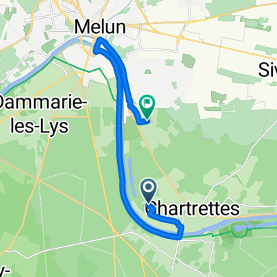 Rue des Chênes, Chartrettes à Rue de la Rochette, Livry-sur-Seine
- Distance
- 13.4 km
- Ascent
- 53 m
- Descent
- 25 m
- Location
- Chartrettes, Île-de-France Region, France
 Chartrettes - Grandpuits
- Distance
- 29.3 km
- Ascent
- 125 m
- Descent
- 63 m
- Location
- Chartrettes, Île-de-France Region, France
Open it in the app