

048 - BS - Möhnesee-Möhneturm (Planung Cross)
A cycling route starting in Bad Sassendorf, North Rhine-Westphalia, Germany.
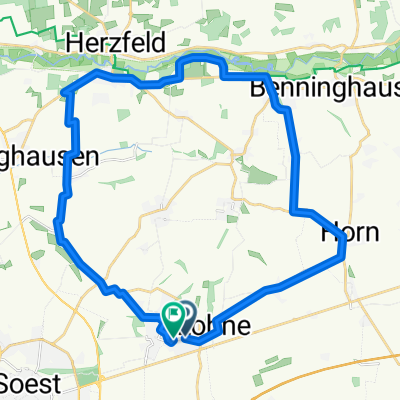
Overview
About this route
um den Westteil (cloned from route 3027859); gefahren 17.05.15, allerdings über Sperrmauer
- -:--
- Duration
- 47.9 km
- Distance
- 409 m
- Ascent
- 409 m
- Descent
- ---
- Avg. speed
- ---
- Avg. speed
Route quality
Waytypes & surfaces along the route
Waytypes
Path
15.6 km
(33 %)
Quiet road
13.1 km
(27 %)
Surfaces
Paved
40 km
(83 %)
Unpaved
3.3 km
(7 %)
Asphalt
38.3 km
(80 %)
Gravel
2 km
(4 %)
Continue with Bikemap
Use, edit, or download this cycling route
You would like to ride 048 - BS - Möhnesee-Möhneturm (Planung Cross) or customize it for your own trip? Here is what you can do with this Bikemap route:
Free features
- Save this route as favorite or in collections
- Copy & plan your own version of this route
- Sync your route with Garmin or Wahoo
Premium features
Free trial for 3 days, or one-time payment. More about Bikemap Premium.
- Navigate this route on iOS & Android
- Export a GPX / KML file of this route
- Create your custom printout (try it for free)
- Download this route for offline navigation
Discover more Premium features.
Get Bikemap PremiumFrom our community
Other popular routes starting in Bad Sassendorf
 Tour 4 - Durch Börde und Münsterland (türkis)
- Distance
- 23.8 km
- Ascent
- 49 m
- Descent
- 46 m
- Location
- Bad Sassendorf, North Rhine-Westphalia, Germany
 Lippetaler Fahrradthon
- Distance
- 42.2 km
- Ascent
- 62 m
- Descent
- 62 m
- Location
- Bad Sassendorf, North Rhine-Westphalia, Germany
 Sonntagsroute
- Distance
- 30.2 km
- Ascent
- 27 m
- Descent
- 41 m
- Location
- Bad Sassendorf, North Rhine-Westphalia, Germany
 Tour 1 - Durch Börde und Münsterland (gelb)
- Distance
- 59.3 km
- Ascent
- 81 m
- Descent
- 80 m
- Location
- Bad Sassendorf, North Rhine-Westphalia, Germany
 Mai 2011: "Durch Börde und Münsterland - Flüsse, Auen und Schlösser"
- Distance
- 44.2 km
- Ascent
- 75 m
- Descent
- 77 m
- Location
- Bad Sassendorf, North Rhine-Westphalia, Germany
 Bad Sassendorf- Bad Westernkotten- Bad Sassendorf
- Distance
- 47.4 km
- Ascent
- 86 m
- Descent
- 88 m
- Location
- Bad Sassendorf, North Rhine-Westphalia, Germany
 Sonntagsnachmittagstour von Bad Sassendorf nach Lippetal 29 JUL 2020.gpx
- Distance
- 29.9 km
- Ascent
- 98 m
- Descent
- 99 m
- Location
- Bad Sassendorf, North Rhine-Westphalia, Germany
 Bad Sassendorfer Nordschleife
- Distance
- 28.1 km
- Ascent
- 58 m
- Descent
- 60 m
- Location
- Bad Sassendorf, North Rhine-Westphalia, Germany
Open it in the app